MyTopo
Steet Mountain Oregon US Topo Map
Couldn't load pickup availability
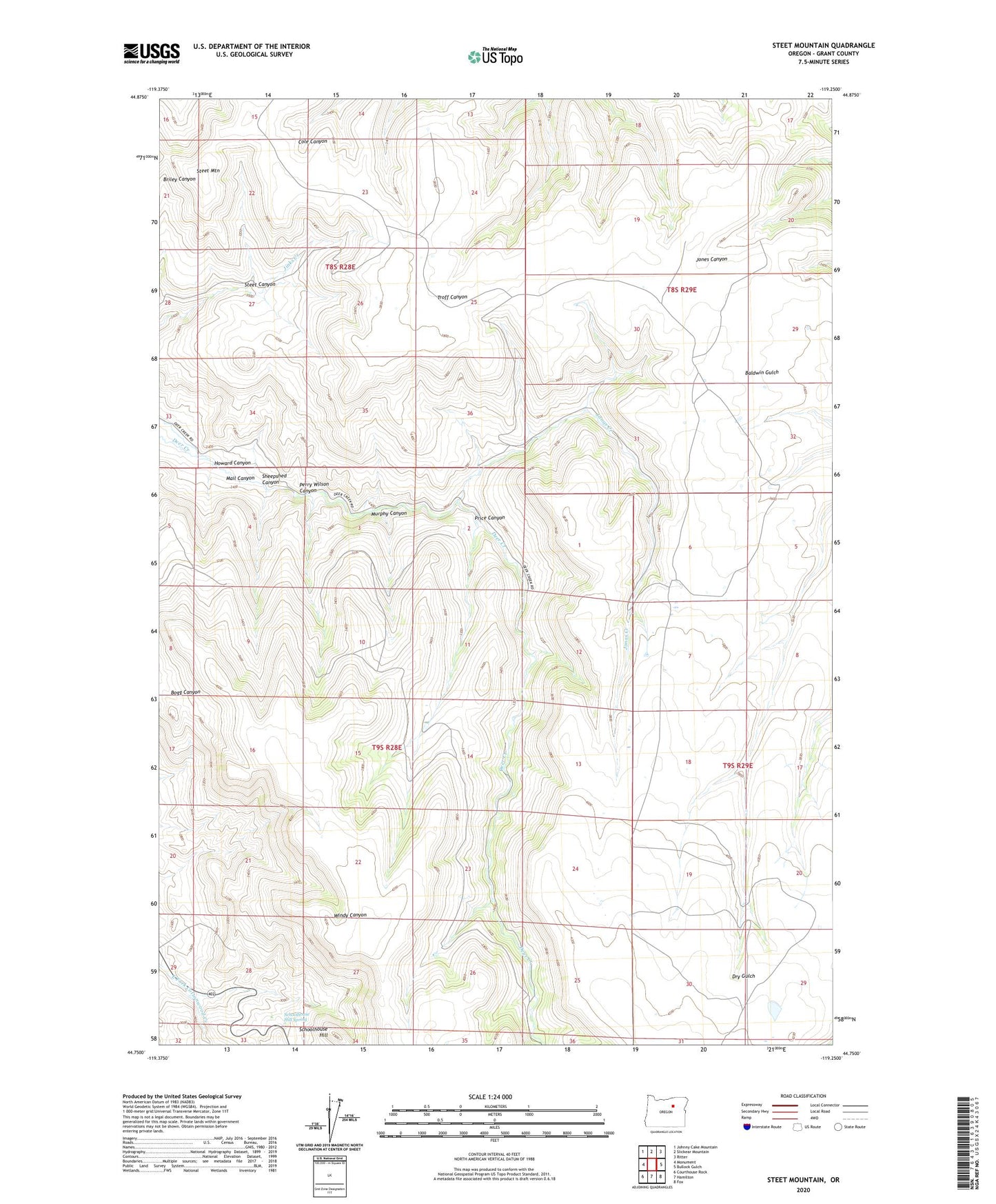
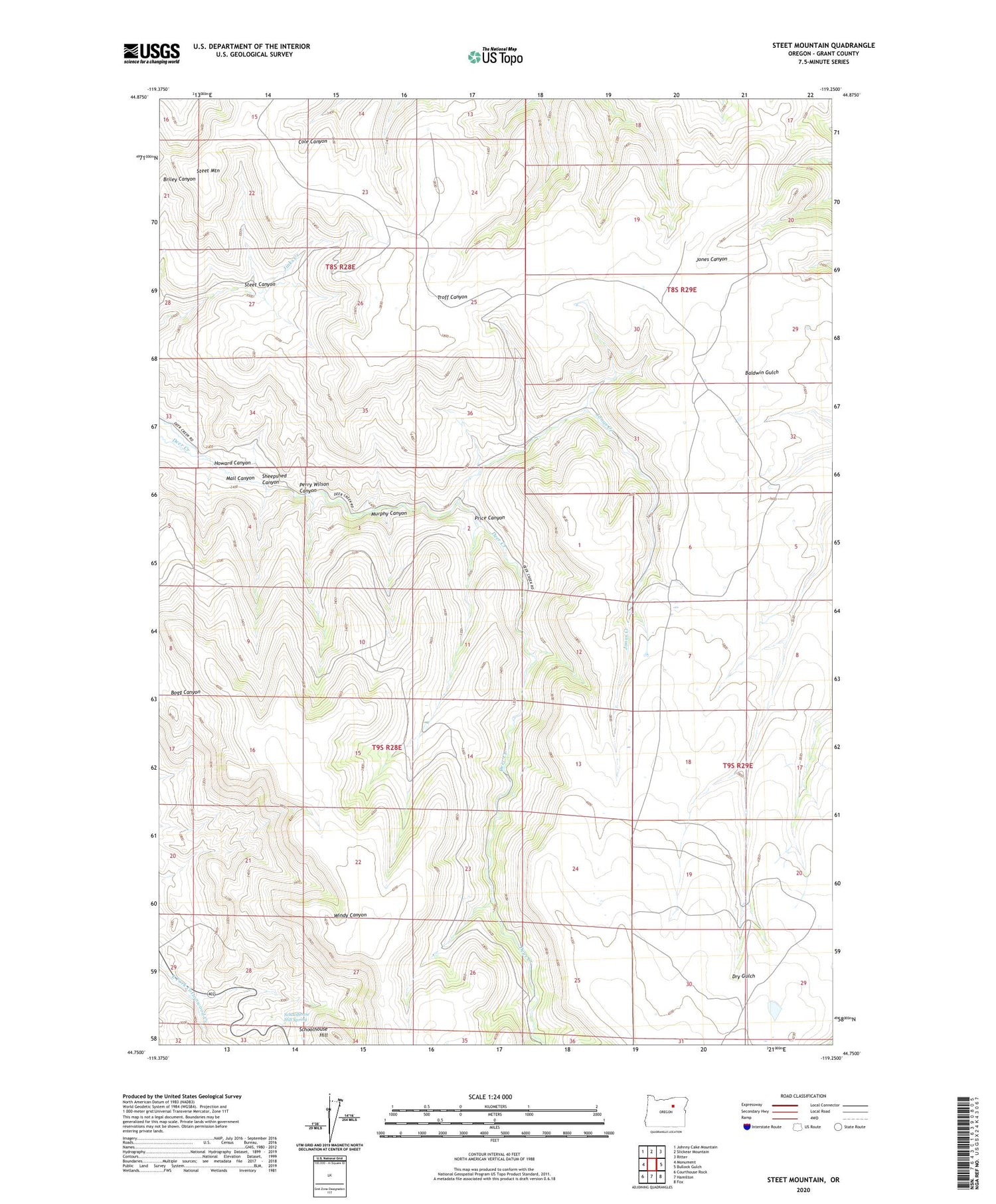
2020 topographic map quadrangle Steet Mountain in the state of Oregon. Scale: 1:24000. Based on the newly updated USGS 7.5' US Topo map series, this map is in the following counties: Grant. The map contains contour data, water features, and other items you are used to seeing on USGS maps, but also has updated roads and other features. This is the next generation of topographic maps. Printed on high-quality waterproof paper with UV fade-resistant inks.
Quads adjacent to this one:
West: Monument
Northwest: Johnny Cake Mountain
North: Slickear Mountain
Northeast: Ritter
East: Bullock Gulch
Southeast: Fox
South: Hamilton
Southwest: Courthouse Rock
Contains the following named places: Howard Canyon, Jonas Creek, Long Creek Division, Mail Canyon, Murphy Canyon, Perry Wilson Canyon, Price Canyon, Schoolhouse Hill, Schoolhouse Hill Spring, Sheepshed Canyon, Steet Canyon, Steet Mountain