MyTopo
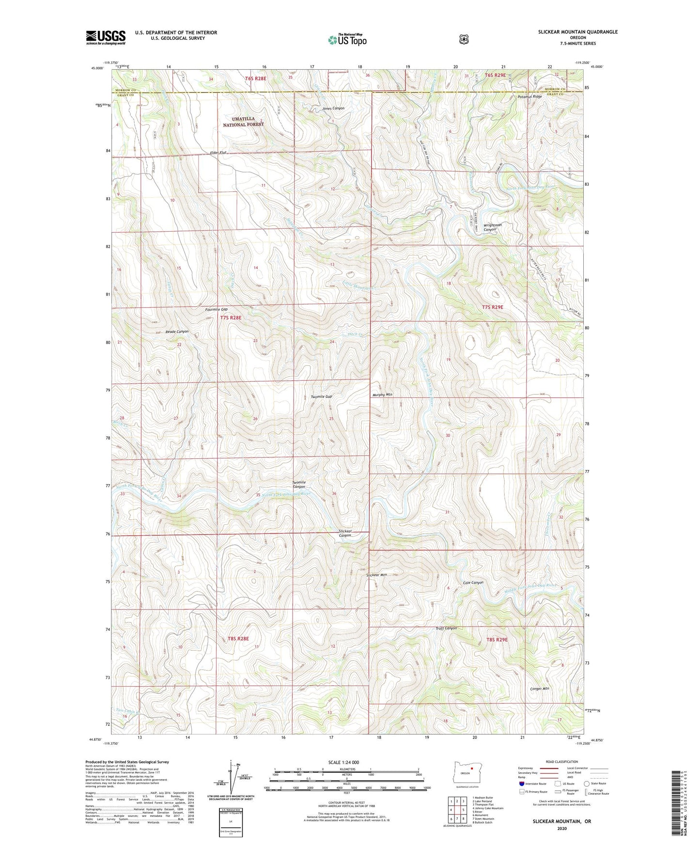
Slickear Mountain Oregon US Topo Map
Couldn't load pickup availability
Also explore the Slickear Mountain Forest Service Topo of this same quad for updated USFS data
2023 topographic map quadrangle Slickear Mountain in the state of Oregon. Scale: 1:24000. Based on the newly updated USGS 7.5' US Topo map series, this map is in the following counties: Grant, Morrow. The map contains contour data, water features, and other items you are used to seeing on USGS maps, but also has updated roads and other features. This is the next generation of topographic maps. Printed on high-quality waterproof paper with UV fade-resistant inks.
Quads adjacent to this one:
West: Johnny Cake Mountain
Northwest: Madison Butte
North: Lake Penland
Northeast: Thompson Flat
East: Ritter
Southeast: Bullock Gulch
South: Steet Mountain
Southwest: Monument
This map covers the same area as the classic USGS quad with code o44119h3.
Contains the following named places: Birch Creek, Cabin Creek, Cole Canyon, Conger Mountain, Ditch Creek, Elder Flat, Fourmile Gap, Graves Creek, Jones Canyon, Little Skaypiya Creek, Mallory Creek, Middle Fork John Day River, Murphy Mountain, Potamus Creek, Potamus Ridge, Reade Canyon, Skaypiya Creek, Slickear Canyon, Slickear Mountain, Threemile Creek, Troff Canyon, Twomile Canyon, Twomile Gap, Wrightman Canyon