MyTopo
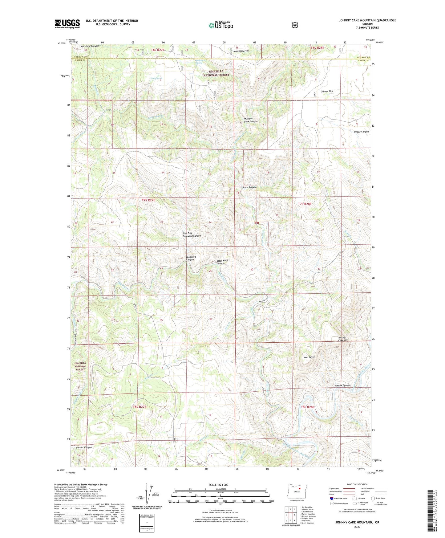
Johnny Cake Mountain Oregon US Topo Map
Couldn't load pickup availability
Also explore the Johnny Cake Mountain Forest Service Topo of this same quad for updated USFS data
2023 topographic map quadrangle Johnny Cake Mountain in the state of Oregon. Scale: 1:24000. Based on the newly updated USGS 7.5' US Topo map series, this map is in the following counties: Grant, Morrow. The map contains contour data, water features, and other items you are used to seeing on USGS maps, but also has updated roads and other features. This is the next generation of topographic maps. Printed on high-quality waterproof paper with UV fade-resistant inks.
Quads adjacent to this one:
West: Turner Mountain
Northwest: Big Rock Flat
North: Madison Butte
Northeast: Lake Penland
East: Slickear Mountain
Southeast: Steet Mountain
South: Monument
Southwest: Bologna Basin
This map covers the same area as the classic USGS quad with code o44119h4.
Contains the following named places: Bacon Creek, Big Wall Creek, Black Rock Canyon, Board Creek, Boneyard Canyon, Buckhorn Spring, Coyote Canyon, East Fork Boneyard Canyon, East Fork Indian Creek, Fern Creek, Gilman Canyon, Gilman Flat, Indian Creek, Johnny Cake Mountain, Little Wall Creek, Lovlett Creek, Minetop Trail, Mulligan Stew Canyon, Neal Butte, Scott Creek, Skookum Creek, Swale Creek, Tonto Spring, Top, Top Post Office, Top School, Two Cabin Creek, Wall Creek