MyTopo
Monument Oregon US Topo Map
Couldn't load pickup availability
Also explore the Monument Forest Service Topo of this same quad for updated USFS data
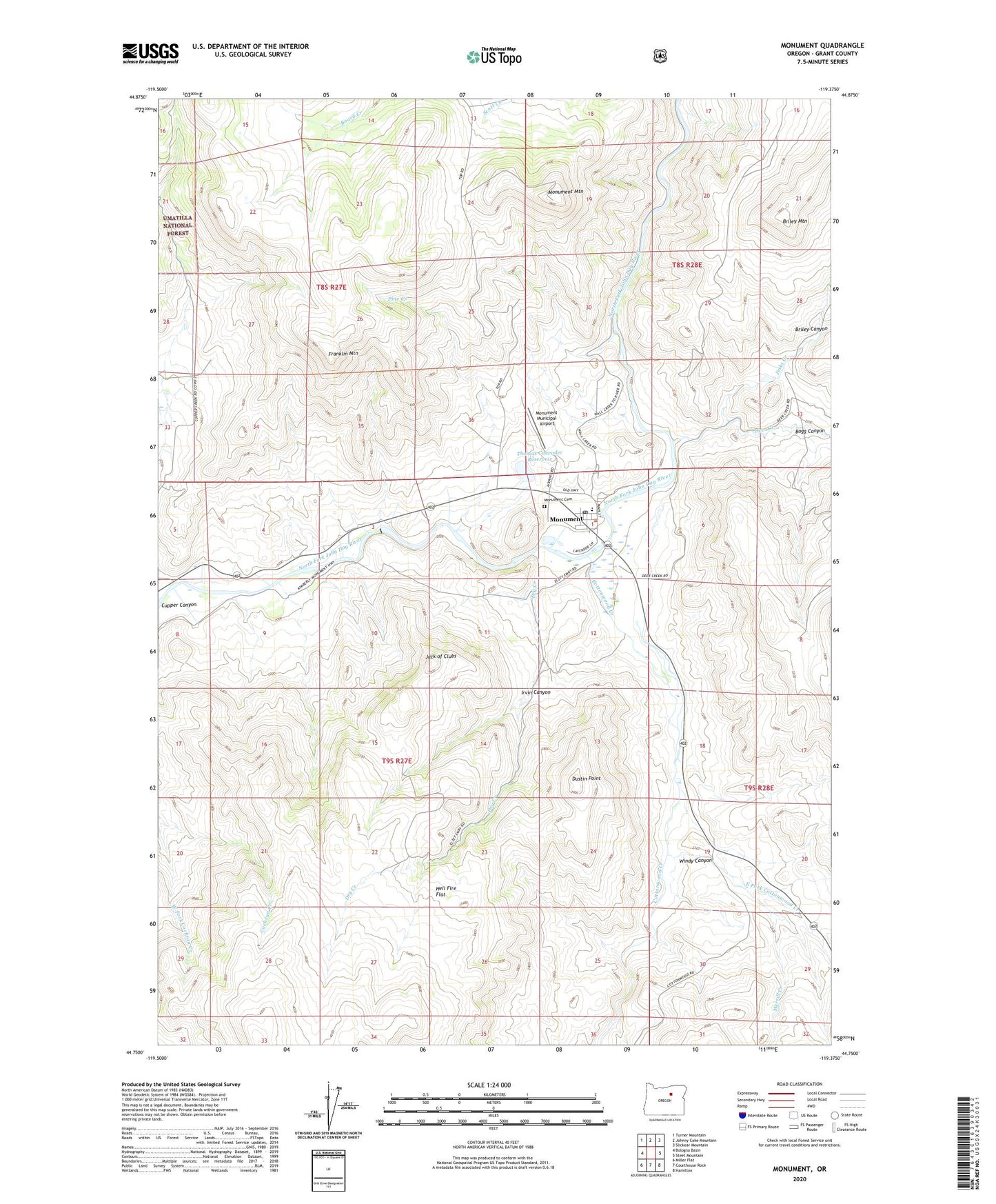
2024 topographic map quadrangle Monument in the state of Oregon. Scale: 1:24000. Based on the newly updated USGS 7.5' US Topo map series, this map is in the following counties: Grant. The map contains contour data, water features, and other items you are used to seeing on USGS maps, but also has updated roads and other features. This is the next generation of topographic maps. Printed on high-quality waterproof paper with UV fade-resistant inks.
Quads adjacent to this one:
West: Bologna Basin
Northwest: Turner Mountain
North: Johnny Cake Mountain
Northeast: Slickear Mountain
East: Steet Mountain
Southeast: Hamilton
South: Courthouse Rock
Southwest: Miller Flat
This map covers the same area as the classic USGS quad with code o44119g4.
Contains the following named places: Bogg Canyon, Briley Canyon, Briley Mountain, City of Monument, Cottonwood Creek, Deer Creek, Dry Creek, Dustin Point, East Fork Cottonwood Creek, Flowers Dam, Franklin Mountain, Hell Fire Flat, Irvin Canyon, Jack of Clubs, Jinks Creek, Merrill Creek, Monument, Monument Cemetery, Monument City Hall, Monument Mountain, Monument Mountain Lookout, Monument Municipal Airport, Monument Post Office, Monument Public Works Department Office, Monument School, Pine Creek, Rail Canyon, Thomas Cavender Reservoir, Windy Canyon, ZIP Code: 97864