MyTopo
Craft Point Oregon US Topo Map
Couldn't load pickup availability
Also explore the Craft Point Forest Service Topo of this same quad for updated USFS data
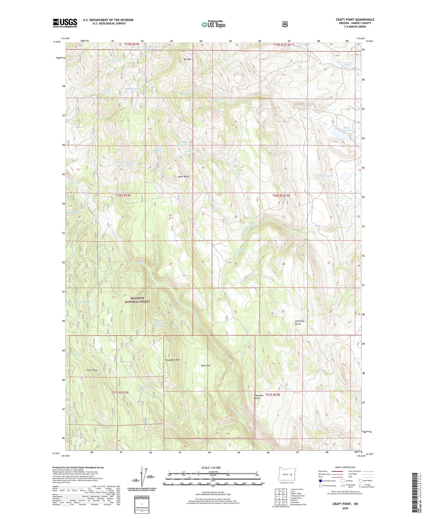
2023 topographic map quadrangle Craft Point in the state of Oregon. Scale: 1:24000. Based on the newly updated USGS 7.5' US Topo map series, this map is in the following counties: Harney. The map contains contour data, water features, and other items you are used to seeing on USGS maps, but also has updated roads and other features. This is the next generation of topographic maps. Printed on high-quality waterproof paper with UV fade-resistant inks.
Quads adjacent to this one:
West: Telephone Butte
Northwest: Calamity Butte
North: Van
Northeast: Moffit Table
East: House Butte
Southeast: Stinkingwater Pass
South: Buchanan
Southwest: Harney
This map covers the same area as the classic USGS quad with code o43118g6.
Contains the following named places: Buck Butte, Craft Point, Craft Spring, Dietrich Ranch, Dietrich Spring, Elephant Butte, Elk Spring, Frog Spring, Halfway Spring, Jones Creek, Jordan Spring, Juniper Spring, Miller Dam, Miller Reservoir, Miller Spring, Morgan Spring, Mount Tom, Pine Creek Cow Camp, Poer Dam, Poer Reservoir, Ralphs Spring, Rifle Spring, Tats Spring, Temple Reservoir, Thompson Mountain, Thompson Spring, Three J Spring, Widow B Spring