MyTopo
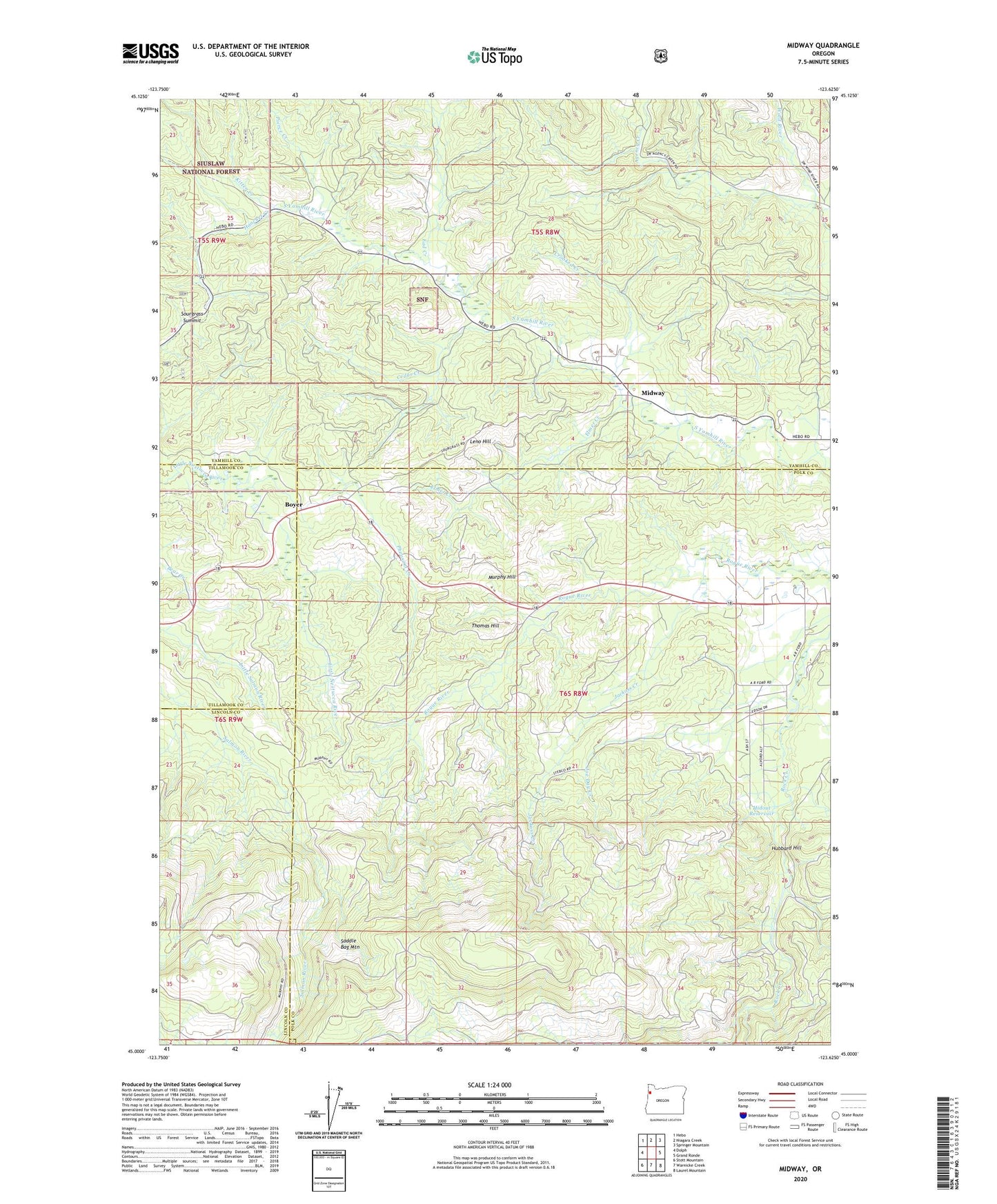
Midway Oregon US Topo Map
Couldn't load pickup availability
Also explore the Midway Forest Service Topo of this same quad for updated USFS data
2024 topographic map quadrangle Midway in the state of Oregon. Scale: 1:24000. Based on the newly updated USGS 7.5' US Topo map series, this map is in the following counties: Yamhill, Polk, Lincoln, Tillamook. The map contains contour data, water features, and other items you are used to seeing on USGS maps, but also has updated roads and other features. This is the next generation of topographic maps. Printed on high-quality waterproof paper with UV fade-resistant inks.
Quads adjacent to this one:
West: Dolph
Northwest: Hebo
North: Niagara Creek
Northeast: Springer Mountain
East: Grand Ronde
Southeast: Laurel Mountain
South: Warnicke Creek
Southwest: Stott Mountain
This map covers the same area as the classic USGS quad with code o45123a6.
Contains the following named places: Bellwood Post Office, Boyer, Cedar Creek, Church in the Wildwood, Crooked Creek, Ead Creek, Elmer Creek, Hanchet Creek, Hayland Post Office, Hidout Reservoir, Hubbard Hill, Jackass Creek, Joe Creek, Joe Day Creek, Kitten Creek, Leno Hill, Midway, Murphy Hill, Pheasant Creek, Pierce Creek, Plum Valley Post Office, Rock Creek Hideout, Sourgrass Summit, Thomas Hill, Wind River, ZIP Code: 97347