MyTopo
Strawberry Butte Oregon US Topo Map
Couldn't load pickup availability
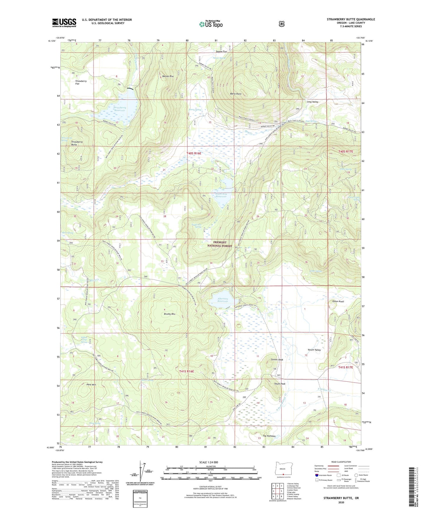
2020 topographic map quadrangle Strawberry Butte in the state of Oregon. Scale: 1:24000. Based on the newly updated USGS 7.5' US Topo map series, this map is in the following counties: Lake. The map contains contour data, water features, and other items you are used to seeing on USGS maps, but also has updated roads and other features. This is the next generation of topographic maps. Printed on high-quality waterproof paper with UV fade-resistant inks.
Quads adjacent to this one:
West: Antler Point
Northwest: Barnes Valley
North: Arkansas Flat
Northeast: Drews Reservoir
East: Dog Lake
Southeast: Beaver Mountain
South: Weed Valley
Southwest: Steele Swamp
Contains the following named places: Adams Spring, Albertson Dam, Albertson Ranch, Albertson Reservoir, Barry Point, Brushy Mountain, Cedar Spring, Center Peak, Devaul Dam, East Willow Creek, Gober Spring, Green Valley Spring, Harp Mountain, Harp Spring, Kenny Spring, Long Valley, Melix Spring, Onion Knoll, Reed Ranch, Sage Spring, South Arm Dam, South Arm Reservoir, South Arm Spring, South Peak, Squaw Spring, Strawberry Butte, Strawberry Flat, Strawberry Reservoir, Strawberry Spring, The Potholes, Willow Camp Spring, Yocum, Yocum Post Office, Yocum Valley