MyTopo
Tamolitch Falls Oregon US Topo Map
Couldn't load pickup availability
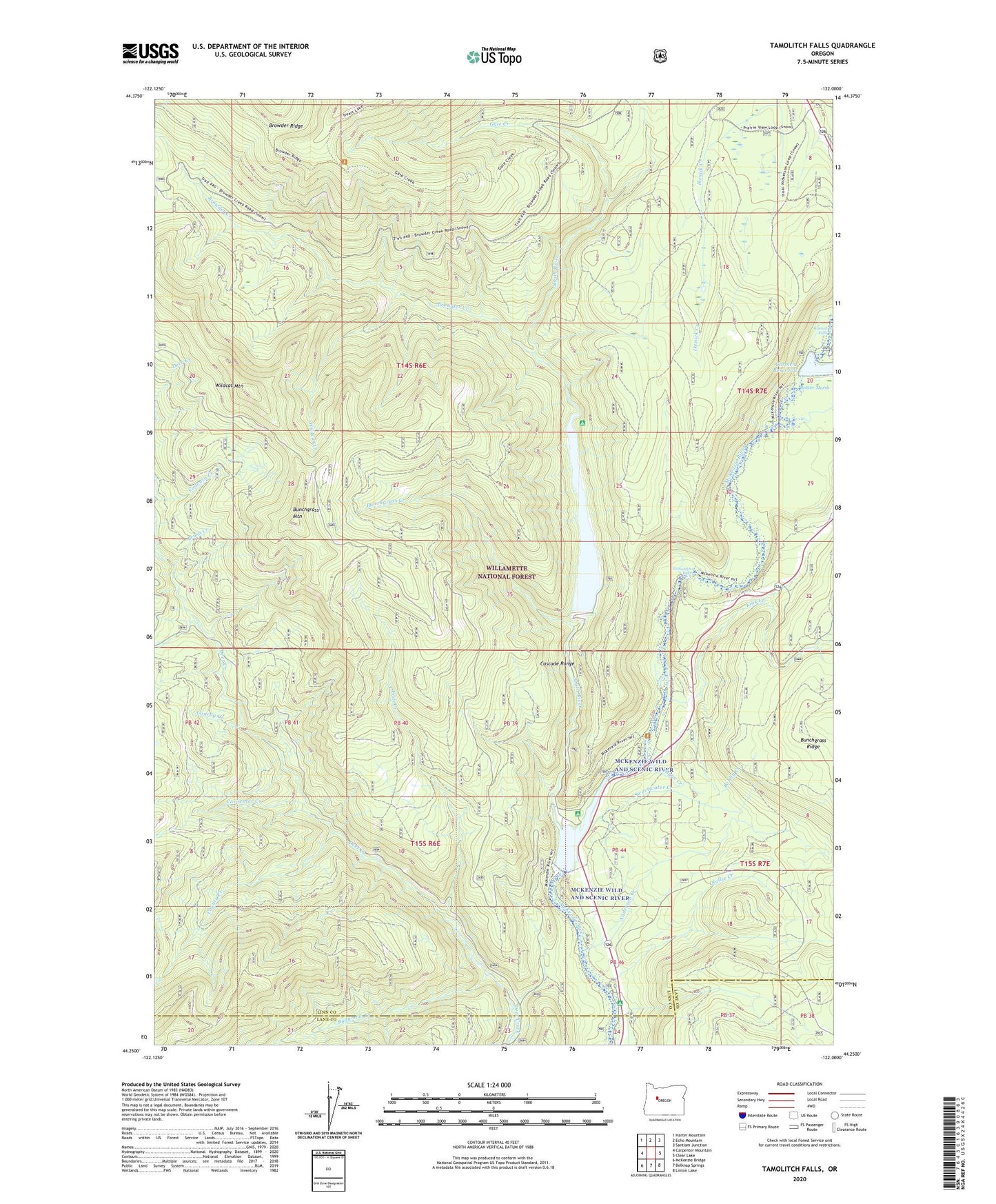
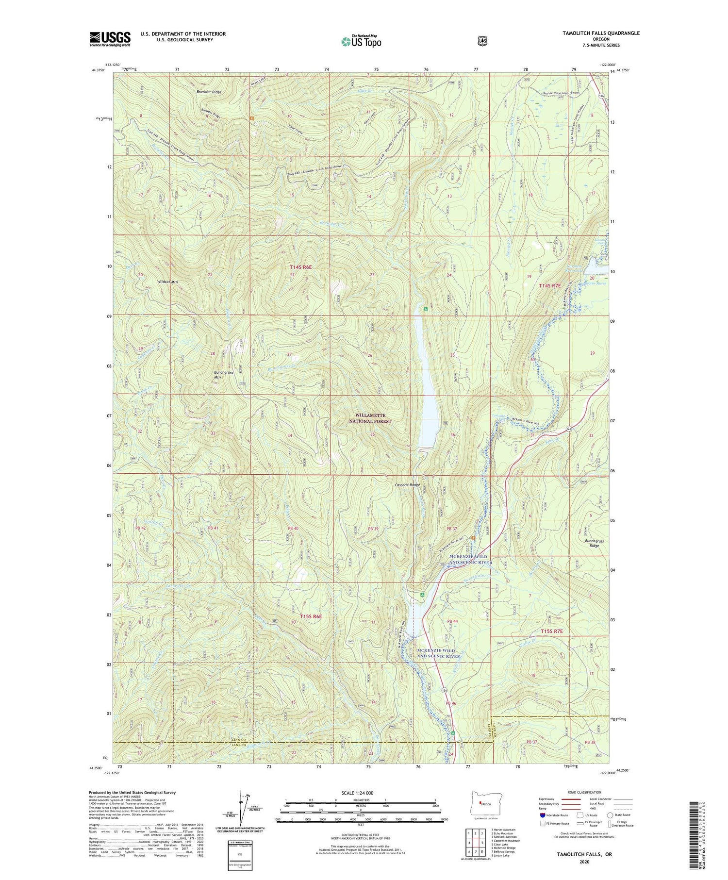
2020 topographic map quadrangle Tamolitch Falls in the state of Oregon. Scale: 1:24000. Based on the newly updated USGS 7.5' US Topo map series, this map is in the following counties: Linn, Lane. The map contains contour data, water features, and other items you are used to seeing on USGS maps, but also has updated roads and other features. This is the next generation of topographic maps. Printed on high-quality waterproof paper with UV fade-resistant inks.
Quads adjacent to this one:
West: Carpenter Mountain
Northwest: Harter Mountain
North: Echo Mountain
Northeast: Santiam Junction
East: Clear Lake
Southeast: Linton Lake
South: Belknap Springs
Southwest: McKenzie Bridge
Contains the following named places: Anderson Creek, Beaver Marsh, Bobby Creek, Browder Creek, Browder Ridge, Browder Ridge Trail, Brush Creek, Budworm Creek, Bunchgrass Creek, Bunchgrass Mountain, Carmen Creek, Carmen Diversion Dam, Carmen Reservoir, Carpenter Creek, Conroy Creek, County Creek, Fritz Creek, Gate Creek, Ice Cap Creek Recreation Site, Kink Creek, Koosah Falls, Lakes End Campground, McKenzie Wild and Scenic River, Olallie Creek, Olallie Creek Campground Boat Ramp, Olallie Recreation Site, Payne Creek, Smith Dam, Smith Prairie Trail, Smith Reservoir, Smith Reservoir Boat Ramp, Smith River, Sweetwater Creek, Tamolitch Falls, Trail Bridge Dam, Trail Bridge Recreation Site, Trail Bridge Reservoir, Trailbridge Campground Boat Ramp, Wildcat Creek, Wildcat Mountain, Wildcat Mountain Research Area