
MyTopo
Upper Soda Oregon US Topo Map
Couldn't load pickup availability
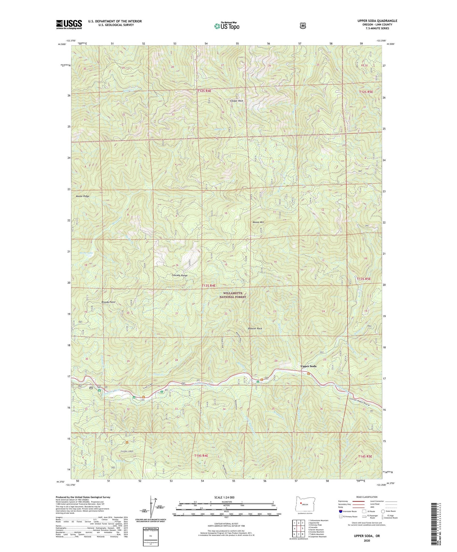
2020 topographic map quadrangle Upper Soda in the state of Oregon. Scale: 1:24000. Based on the newly updated USGS 7.5' US Topo map series, this map is in the following counties: Linn. The map contains contour data, water features, and other items you are used to seeing on USGS maps, but also has updated roads and other features. This is the next generation of topographic maps. Printed on high-quality waterproof paper with UV fade-resistant inks.
Quads adjacent to this one:
West: Cascadia
Northwest: Yellowstone Mountain
North: Quartzville
Northeast: Chimney Peak
East: Harter Mountain
Southeast: Carpenter Mountain
South: Tidbits Mountain
Southwest: Swamp Mountain
Contains the following named places: Bloody Point, Boulder Creek, Channel Creek, Cougar Rock, East Linn Division, Elk Creek, Fernview Recreation Site, Garrison Post Office, Harter Creek, Husky Creek, Keith Creek, Little Boulder Creek, Menagerie Wilderness, Moose Lake, Moose Mountain, Moose Ridge, Rooster Creek, Rooster Rock, Soda Fork, Stewart Creek, Taylor Creek, Trout Creek, Trout Creek Recreation Site, Upper Soda, Yukwah Recreation Site


