MyTopo
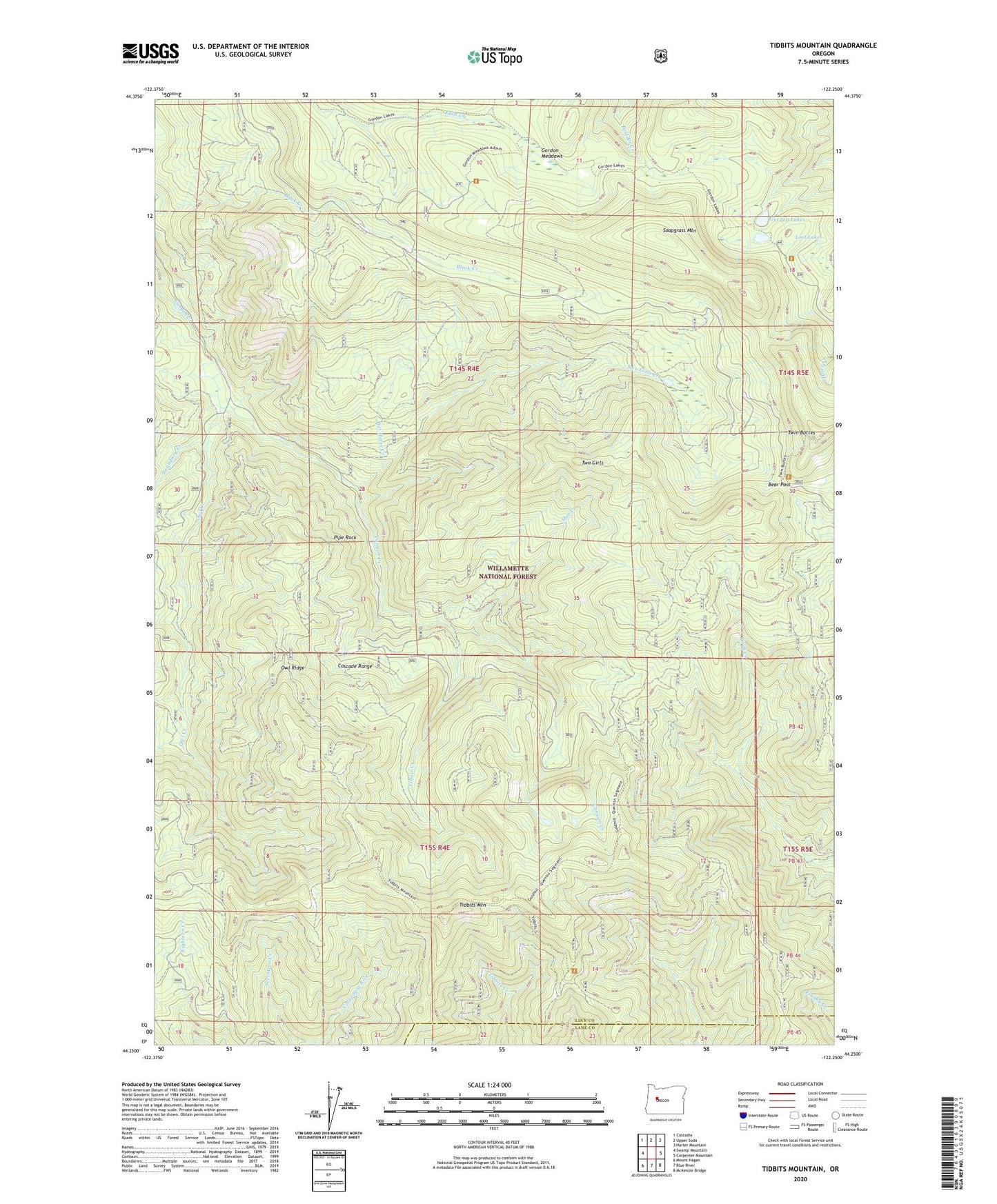
Tidbits Mountain Oregon US Topo Map
Couldn't load pickup availability
Also explore the Tidbits Mountain Forest Service Topo of this same quad for updated USFS data
2023 topographic map quadrangle Tidbits Mountain in the state of Oregon. Scale: 1:24000. Based on the newly updated USGS 7.5' US Topo map series, this map is in the following counties: Linn, Lane. The map contains contour data, water features, and other items you are used to seeing on USGS maps, but also has updated roads and other features. This is the next generation of topographic maps. Printed on high-quality waterproof paper with UV fade-resistant inks.
Quads adjacent to this one:
West: Swamp Mountain
Northwest: Cascadia
North: Upper Soda
Northeast: Harter Mountain
East: Carpenter Mountain
Southeast: McKenzie Bridge
South: Blue River
Southwest: Mount Hagan
This map covers the same area as the classic USGS quad with code o44122c3.
Contains the following named places: Bear Pass, Boundary Creek, Coley Creek, Cul de Sac Creek, Elbow Creek, Gold Hill Trail, Gordon Lakes, Gordon Meadows, Loon Creek, Lost Lake, Moe Creek, Owl Creek, Owl Ridge, Pipe Rock, Seventeen Creek, Soapgrass Mountain, Tidbits Mountain, Two Girls, Two Girls Creek, Wet Horse Creek