MyTopo
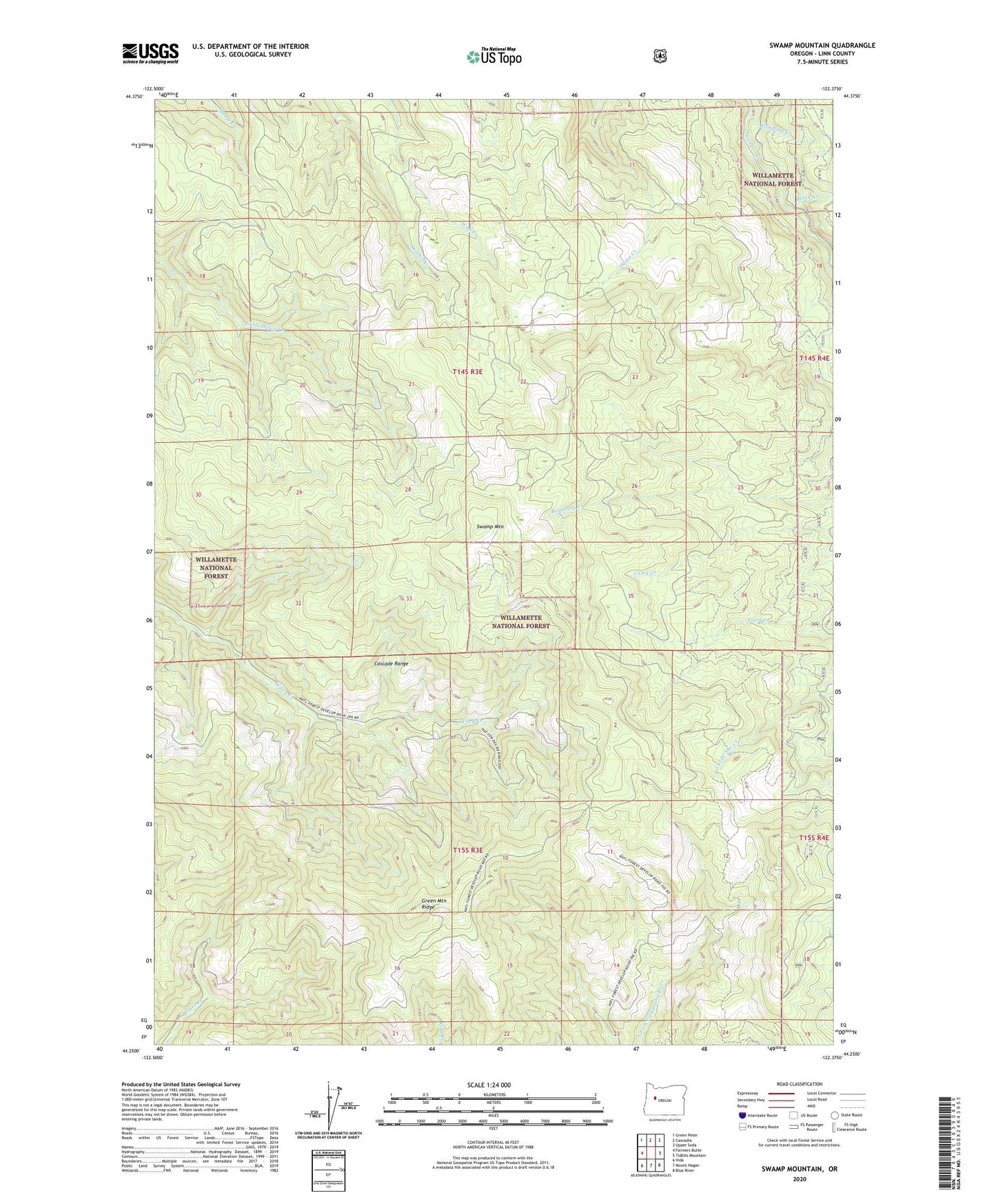
Swamp Mountain Oregon US Topo Map
Couldn't load pickup availability
Also explore the Swamp Mountain Forest Service Topo of this same quad for updated USFS data
2023 topographic map quadrangle Swamp Mountain in the state of Oregon. Scale: 1:24000. Based on the newly updated USGS 7.5' US Topo map series, this map is in the following counties: Linn. The map contains contour data, water features, and other items you are used to seeing on USGS maps, but also has updated roads and other features. This is the next generation of topographic maps. Printed on high-quality waterproof paper with UV fade-resistant inks.
Quads adjacent to this one:
West: Farmers Butte
Northwest: Green Peter
North: Cascadia
Northeast: Upper Soda
East: Tidbits Mountain
Southeast: Blue River
South: Mount Hagan
Southwest: Vida
This map covers the same area as the classic USGS quad with code o44122c4.
Contains the following named places: Black Creek, Flimflam Creek, Green Mountain Lookout Tower, Swamp Mountain