MyTopo
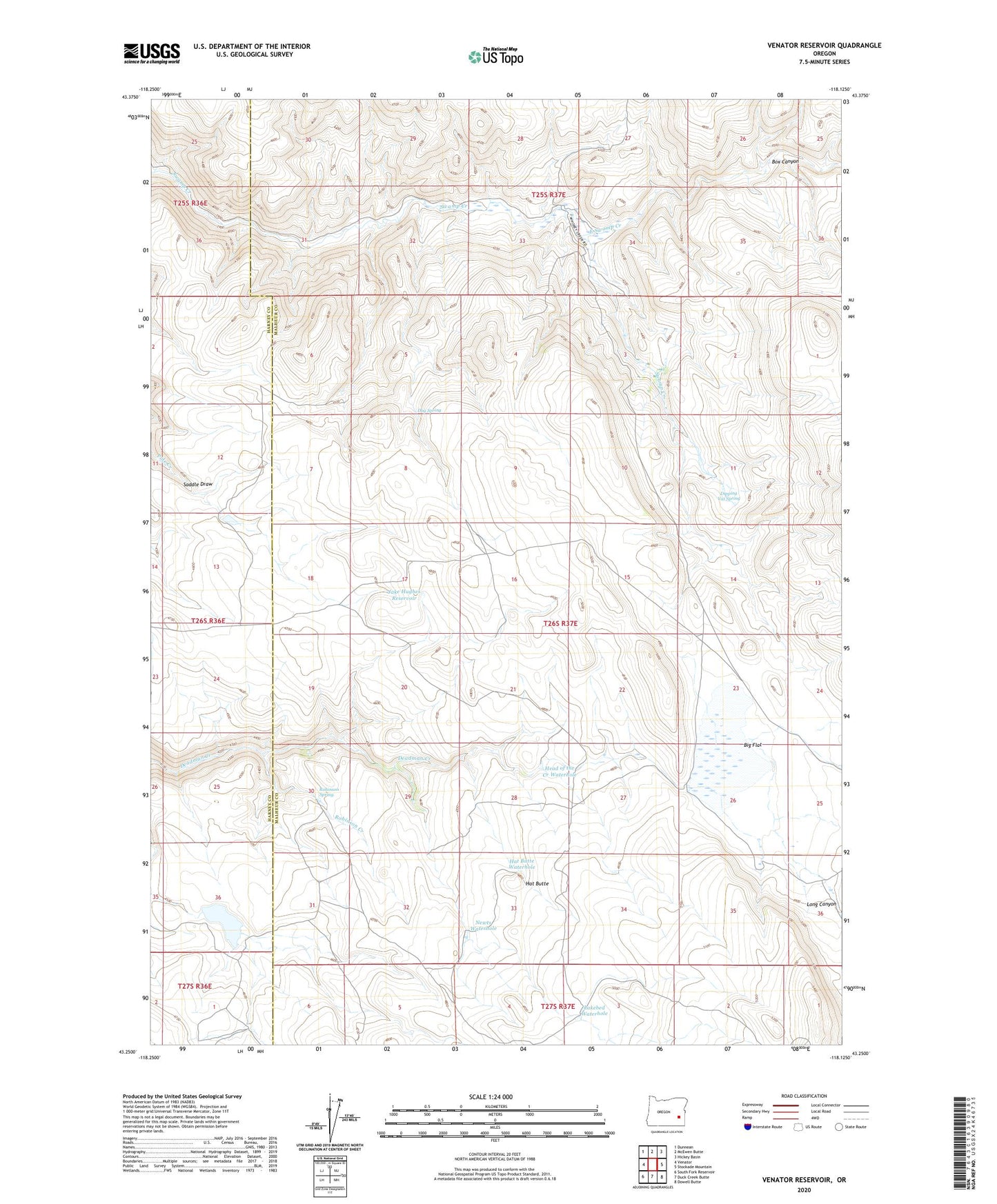
Venator Reservoir Oregon US Topo Map
Couldn't load pickup availability
2023 topographic map quadrangle Venator Reservoir in the state of Oregon. Scale: 1:24000. Based on the newly updated USGS 7.5' US Topo map series, this map is in the following counties: Malheur, Harney. The map contains contour data, water features, and other items you are used to seeing on USGS maps, but also has updated roads and other features. This is the next generation of topographic maps. Printed on high-quality waterproof paper with UV fade-resistant inks.
Quads adjacent to this one:
West: Venator
Northwest: Dunnean
North: McEwen Butte
Northeast: Hickey Basin
East: Stockade Mountain
Southeast: Dowell Butte
South: Duck Creek Butte
Southwest: South Fork Reservoir
This map covers the same area as the classic USGS quad with code o43118c2.
Contains the following named places: Big Flat, Box Canyon, Dipping Vat Spring, Dog Spring, East Swamp Creek, Hat Butte, Hat Butte Waterhole, Head of the Creek Waterhole, Jake Hughes Reservoir, Lakebed Waterhole, Long Canyon, Newts Waterhole, Robinson Creek, Robinson Spring, Swamp Creek Ranch, Venator Reservoir