MyTopo
Hickey Basin Oregon US Topo Map
Couldn't load pickup availability
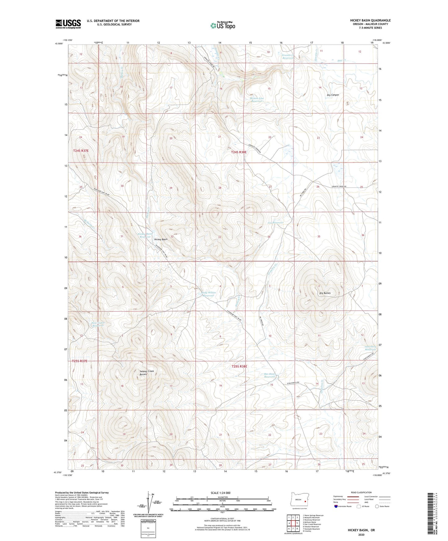
2023 topographic map quadrangle Hickey Basin in the state of Oregon. Scale: 1:24000. Based on the newly updated USGS 7.5' US Topo map series, this map is in the following counties: Malheur. The map contains contour data, water features, and other items you are used to seeing on USGS maps, but also has updated roads and other features. This is the next generation of topographic maps. Printed on high-quality waterproof paper with UV fade-resistant inks.
Quads adjacent to this one:
West: McEwen Butte
Northwest: Warm Springs Reservoir
North: Mosquito Mountain
Northeast: Shumway Reservoir
East: Star Creek Reservoir
Southeast: Crowley
South: Stockade Mountain
Southwest: Venator Reservoir
This map covers the same area as the classic USGS quad with code o43118d1.
Contains the following named places: Andy Wilson Reservoir, Atterbury Reservoir, Bar Heart Reservoir, Beers Dam, Cat Reservoir, Chapman Dam, Chapman Reservoir, Creston Cabin, Dry Buttes, Dry Canyon, Granite Creek Reservoir, Hickey Basin, Hickey Basin Reservoir, New Visher Reservoir, Section Line Reservoir, Star Creek, Summit Reservoir, Swamp Creek Buttes, Walls Reservoir