MyTopo
McEwen Butte Oregon US Topo Map
Couldn't load pickup availability
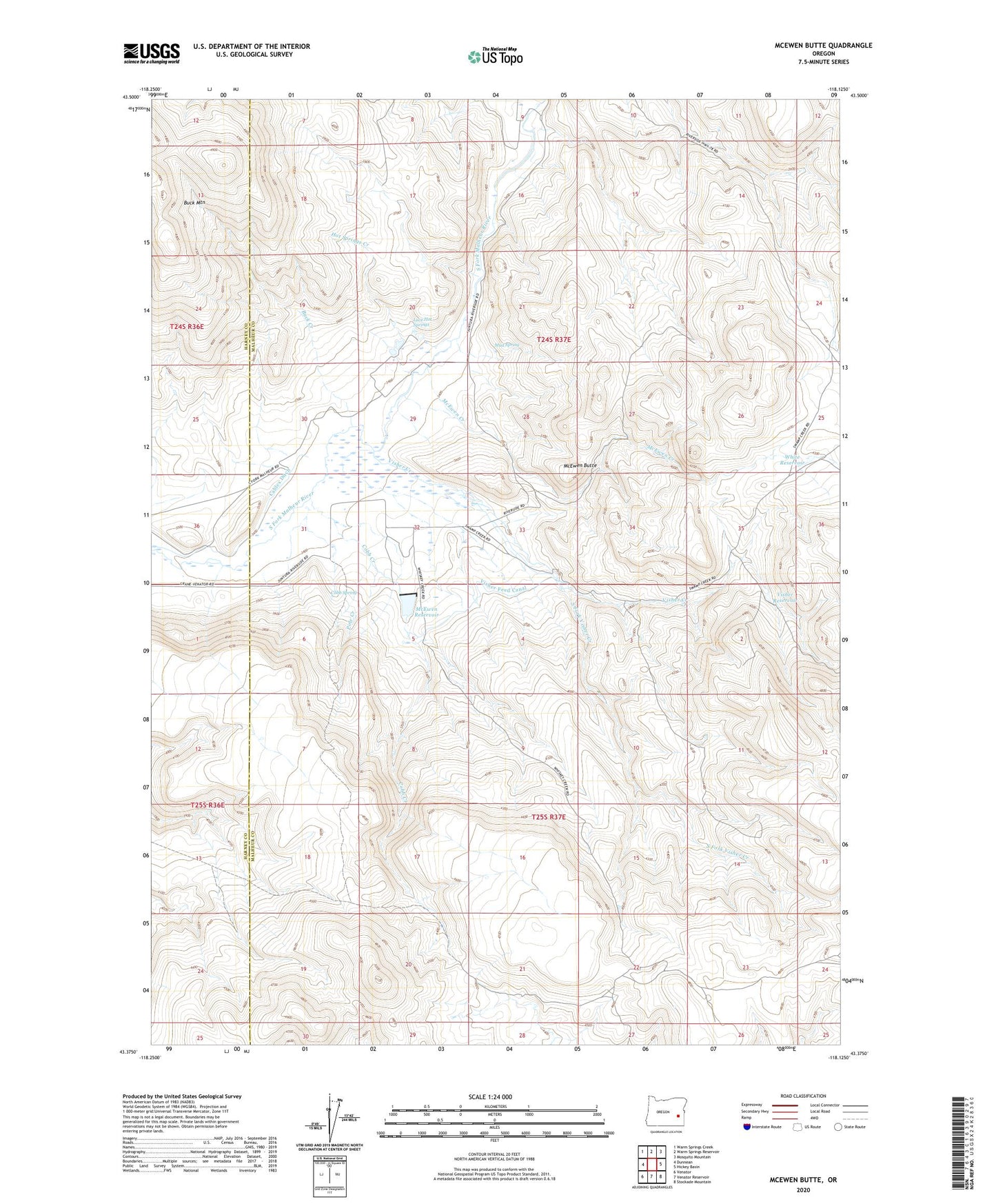
2023 topographic map quadrangle McEwen Butte in the state of Oregon. Scale: 1:24000. Based on the newly updated USGS 7.5' US Topo map series, this map is in the following counties: Malheur, Harney. The map contains contour data, water features, and other items you are used to seeing on USGS maps, but also has updated roads and other features. This is the next generation of topographic maps. Printed on high-quality waterproof paper with UV fade-resistant inks.
Quads adjacent to this one:
West: Dunnean
Northwest: Warm Springs Creek
North: Warm Springs Reservoir
Northeast: Mosquito Mountain
East: Hickey Basin
Southeast: Stockade Mountain
South: Venator Reservoir
Southwest: Venator
This map covers the same area as the classic USGS quad with code o43118d2.
Contains the following named places: Buck Creek, Cables Ditch, Cobb Creek, Cobb Creek Dam, Cobb Spring, Fort, Hot Springs Creek, Luce Hot Springs, McEwen Butte, McEwen Creek, McEwen Ranch, McEwen Reservoir, McRae Homestead, Mud Spring, Pole Creek, South Fork Visher Creek, Spurlock Ranch, Visher Creek, Visher Feed Canal, Visher Reservoir, White Reservoir