
MyTopo
Veneta Oregon US Topo Map
Couldn't load pickup availability
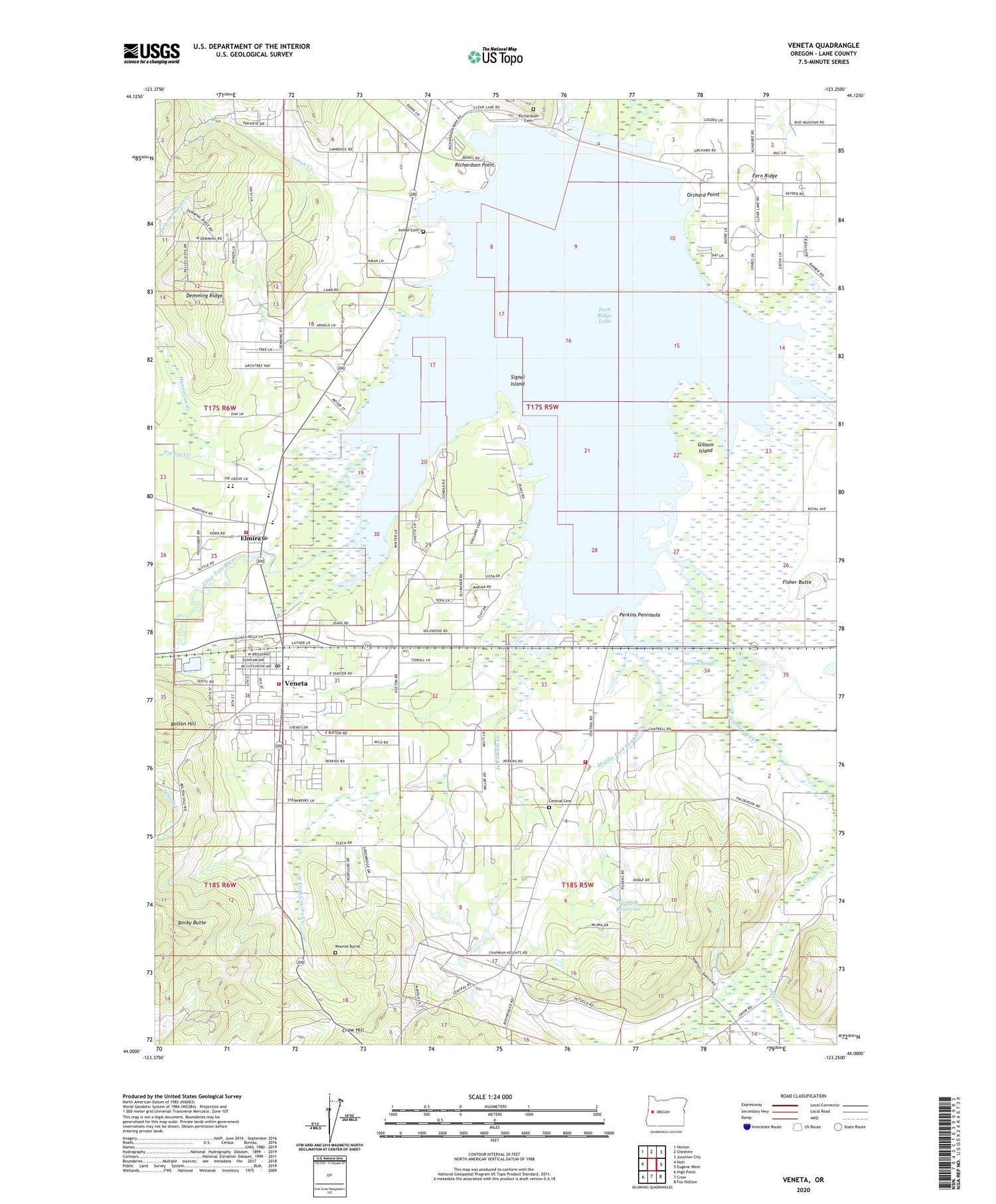
2020 topographic map quadrangle Veneta in the state of Oregon. Scale: 1:24000. Based on the newly updated USGS 7.5' US Topo map series, this map is in the following counties: Lane. The map contains contour data, water features, and other items you are used to seeing on USGS maps, but also has updated roads and other features. This is the next generation of topographic maps. Printed on high-quality waterproof paper with UV fade-resistant inks.
Quads adjacent to this one:
West: Noti
Northwest: Horton
North: Cheshire
Northeast: Junction City
East: Eugene West
Southeast: Fox Hollow
South: Crow
Southwest: High Point
Contains the following named places: Applegate Pioneer Museum, Bethany Church of Franklin Oregon, Bolton Hill, Cardiff, Central Cemetery, Central Elementary School, City of Veneta, Countryside Seventh Day Adventist School, Coyote Creek, Davis Reservoir, Demming Ridge, Elmira, Elmira Census Designated Place, Elmira Church of Christ, Elmira Elementary School, Elmira High School, Elmira Post Office, Eugene Yacht Club, Fern Ridge, Fern Ridge Dam, Fern Ridge Lake, Fern Ridge Library, Fern Ridge Middle School, Fern Ridge Shores, Fern Ridge Shores RV Park Boat Ramp, Fisher Butte, Gibson Island, Griffith Reservoir, Hannavan Creek, Indian Creek, Inman Cemetery, Inman Creek, Jetson, Job Swale Creek, Krugur Park, Lane County Fire District 1 Station 101, Lane County Fire District 1 Station 102, Lane County Fire District 1 Station 105, Lane County Public Works Shop Zone 2, Lane County Public Works Shop Zone 4, Lane Transit District Park and Ride, Llewellyn Post Office, Maywood, Middle Fork Coyote Creek, Mounse Burial, Oak Island Park, Olivet Baptist Church, Orchard Point, Orchard Point Park, Orchard Point Park Boat Ramp, Parker Creek, Perkins Mill, Perkins Peninsula, Perkins Peninsula County Park, Perkins Penninsula Boat Ramp, Richardson Cemetery, Richardson County Park, Richardson Park, Richardson Park Boat Ramp, Richardson Point, Rocky Butte, Saint Thomas Becket Academy, Signal Island, Spencer Creek, Union High School, Veneta, Veneta City Hall, Veneta Elementary School, Veneta Municipal Court, Veneta Post Office, Veneta Wastewater Treatment Facility, Veneta Water Treatment, Veneta Wellhead, Warren Slough, West Fork Coyote Creek, Zumwalt County Park


