MyTopo
Crow Oregon US Topo Map
Couldn't load pickup availability
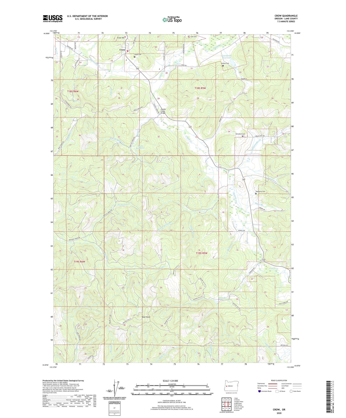
2023 topographic map quadrangle Crow in the state of Oregon. Scale: 1:24000. Based on the newly updated USGS 7.5' US Topo map series, this map is in the following counties: Lane. The map contains contour data, water features, and other items you are used to seeing on USGS maps, but also has updated roads and other features. This is the next generation of topographic maps. Printed on high-quality waterproof paper with UV fade-resistant inks.
Quads adjacent to this one:
West: High Point
Northwest: Noti
North: Veneta
Northeast: Eugene West
East: Fox Hollow
Southeast: Lorane
South: Letz Creek
Southwest: Beaver Creek
This map covers the same area as the classic USGS quad with code o43123h3.
Contains the following named places: Applegate Elementary School, Battle Creek, Bear Creek, Beaver Creek, Chicken Whistle Creek, Coyote Creek Bridge, Crow, Crow Hill, Crow Middle - High School, Crow Post Office, Ford Farms Dam, Ford Farms Reservoir, Gates Cemetery, Gates Creek, Gillespie Corners, Hadleyville, Hadleyville Post Office, Hadleyville School, Hayes Branch, Heatherly Cemetery, Jenkins Cemetery, Jordan Creek, Lane County Fire District 1 Station 111, Liles Cemetery, Lone Cedar School, McCulloch Cemetery, Mirth Post Office, Nighswander Creek, Powell Branch, Shaw Burn, Smith Reservoir, Sturtevant Creek, Swing Log Creek, West Fork Battle Creek, Wolf Point