MyTopo
Fox Hollow Oregon US Topo Map
Couldn't load pickup availability
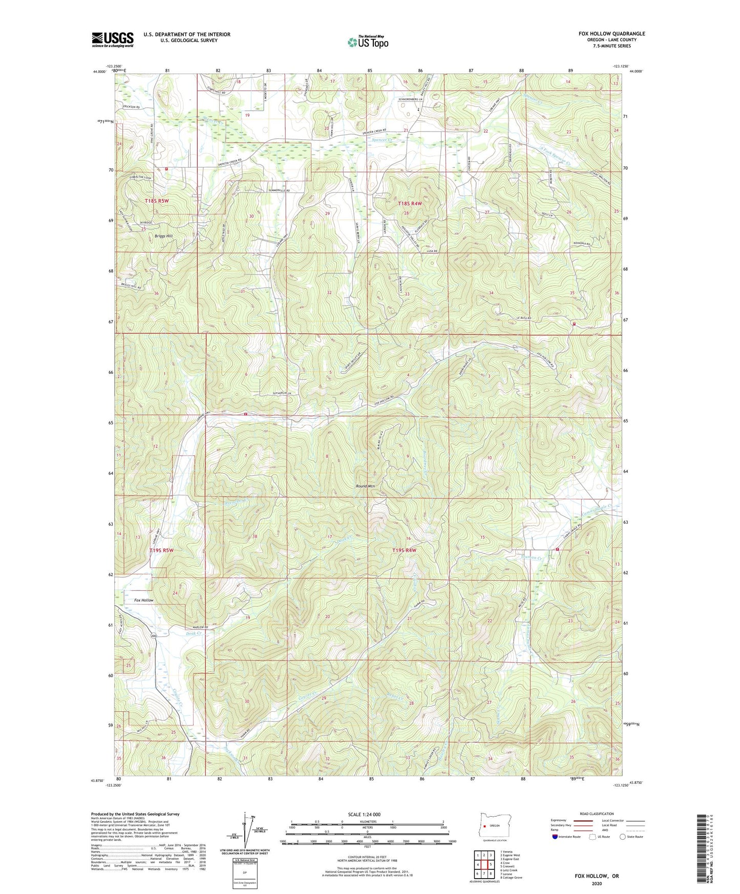
2023 topographic map quadrangle Fox Hollow in the state of Oregon. Scale: 1:24000. Based on the newly updated USGS 7.5' US Topo map series, this map is in the following counties: Lane. The map contains contour data, water features, and other items you are used to seeing on USGS maps, but also has updated roads and other features. This is the next generation of topographic maps. Printed on high-quality waterproof paper with UV fade-resistant inks.
Quads adjacent to this one:
West: Crow
Northwest: Veneta
North: Eugene West
Northeast: Eugene East
East: Creswell
Southeast: Cottage Grove
South: Lorane
Southwest: Letz Creek
This map covers the same area as the classic USGS quad with code o43123h2.
Contains the following named places: Boardtree Creek, Briggs Hill, Doak Creek, Fox Hollow, Fox Hollow Post Office, Jackson Creek, La Bleu School, Lane County Fire District 1 Station 107, Lane County Fire District 1 Station 108, Lane County Fire District 1 Station 109, Preacher Creek, Rebel Creek, Round Mountain, Siuslaw, Siuslaw Post Office, Skunk Creek, South Fork Spencer Creek, South Lane County Fire and Rescue Station 2 - 4, Spencer Creek, Spencer Creek Post Office, Spencers Butte Post Office, Truman Creek, Twin Oaks Elementary School, ZIP Code: 97405