MyTopo
Wapinitia Oregon US Topo Map
Couldn't load pickup availability
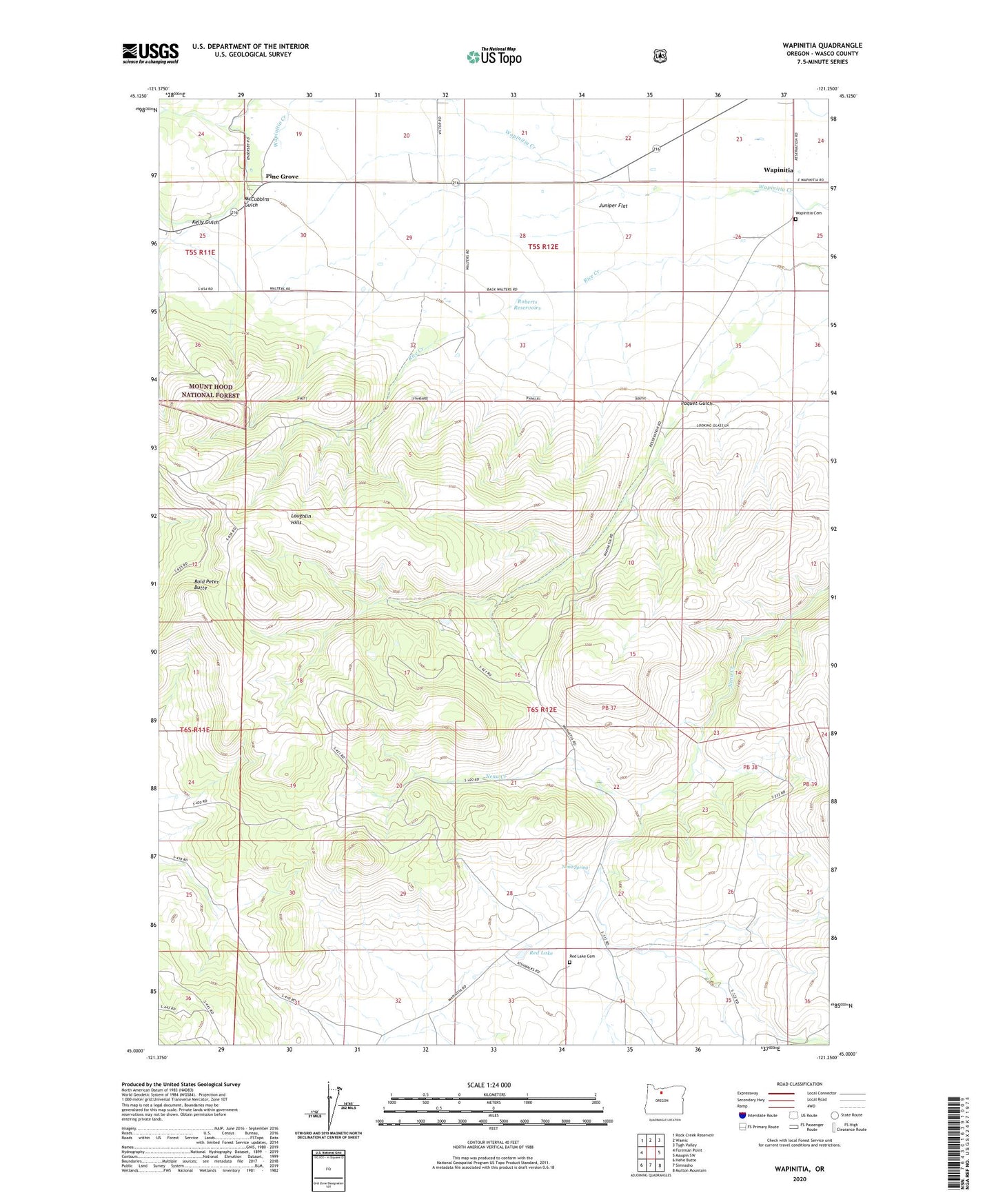
2020 topographic map quadrangle Wapinitia in the state of Oregon. Scale: 1:24000. Based on the newly updated USGS 7.5' US Topo map series, this map is in the following counties: Wasco. The map contains contour data, water features, and other items you are used to seeing on USGS maps, but also has updated roads and other features. This is the next generation of topographic maps. Printed on high-quality waterproof paper with UV fade-resistant inks.
Quads adjacent to this one:
West: Foreman Point
Northwest: Rock Creek Reservoir
North: Wamic
Northeast: Tygh Valley
East: Maupin SW
Southeast: Mutton Mountain
South: Simnasho
Southwest: Hehe Butte
Contains the following named places: Bald Peter Butte, Byzandine Gulch, Helen Lake, Kelly Gulch, Kelly Lateral, Laughlin Hills, McCubbins Gulch, Nena Spring, Oak Grove School, Paquet Gulch, Pine Grove, Pine Grove Census Designated Place, Rainbow Quarry, Red Lake, Red Lake Cemetery, Roberts Reservoirs, Wapinitia, Wapinitia Cemetery, Wapinitia Post Office