MyTopo
Adams Oregon US Topo Map
Couldn't load pickup availability
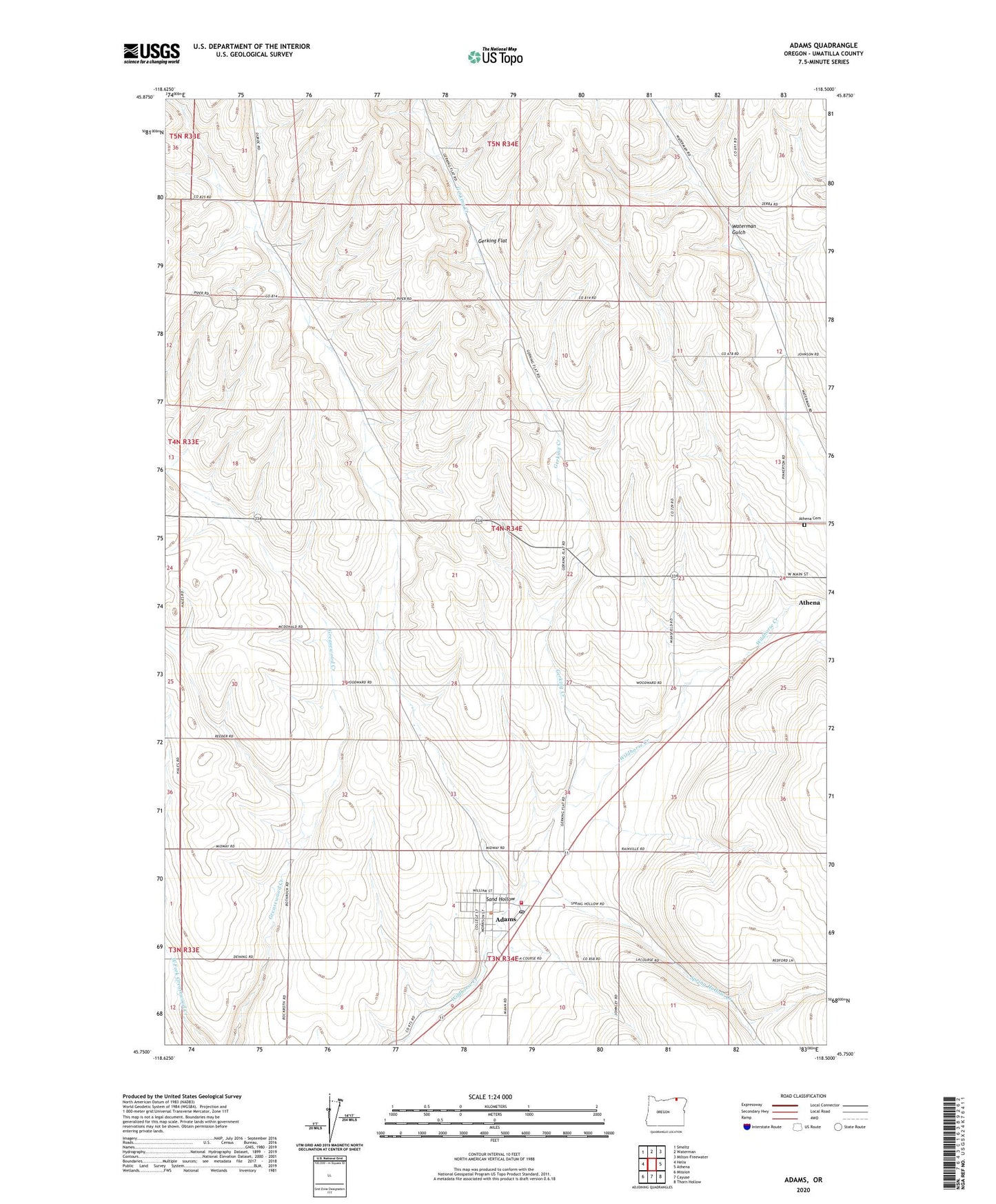
2023 topographic map quadrangle Adams in the state of Oregon. Scale: 1:24000. Based on the newly updated USGS 7.5' US Topo map series, this map is in the following counties: Umatilla. The map contains contour data, water features, and other items you are used to seeing on USGS maps, but also has updated roads and other features. This is the next generation of topographic maps. Printed on high-quality waterproof paper with UV fade-resistant inks.
Quads adjacent to this one:
West: Helix
Northwest: Smeltz
North: Waterman
Northeast: Milton-Freewater
East: Athena
Southeast: Thorn Hollow
South: Cayuse
Southwest: Mission
This map covers the same area as the classic USGS quad with code o45118g5.
Contains the following named places: Adam Public Works Department, Adams, Adams City Hall, Adams City Park, Adams Post Office, Adams Public Library, Athena Cemetery, City of Adams, Davis Airstrip, East Umatilla County Rural Fire Protection District Station 2, Gerking Creek, Gerking Flat, Sand Hollow, Spring Hollow Creek, Waterman Gulch, West Fork Spring Hollow Creek, ZIP Code: 97813