MyTopo
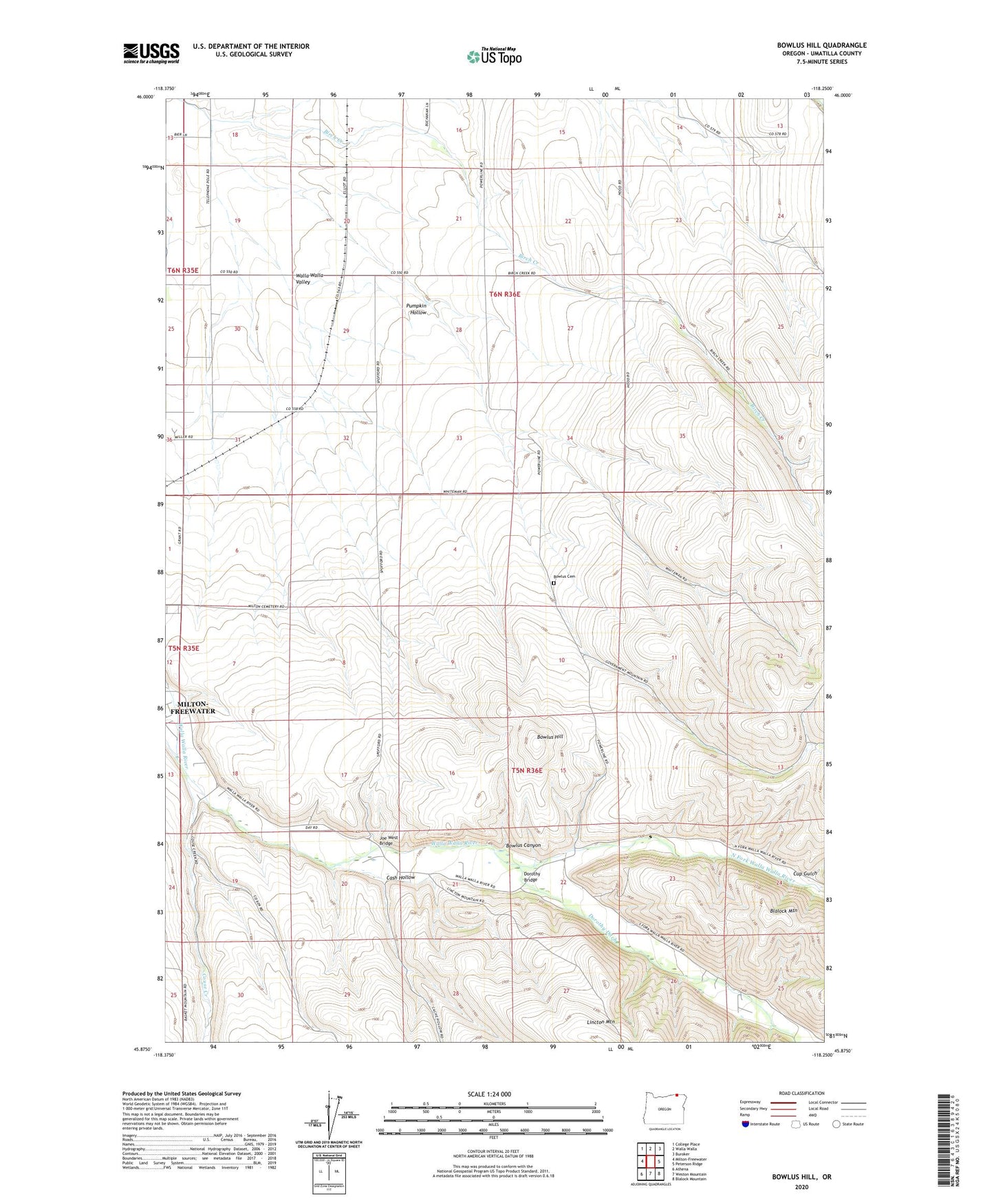
Bowlus Hill Oregon US Topo Map
Couldn't load pickup availability
2023 topographic map quadrangle Bowlus Hill in the state of Oregon. Scale: 1:24000. Based on the newly updated USGS 7.5' US Topo map series, this map is in the following counties: Umatilla. The map contains contour data, water features, and other items you are used to seeing on USGS maps, but also has updated roads and other features. This is the next generation of topographic maps. Printed on high-quality waterproof paper with UV fade-resistant inks.
Quads adjacent to this one:
West: Milton-Freewater
Northwest: College Place
North: Walla Walla
Northeast: Buroker
East: Peterson Ridge
Southeast: Blalock Mountain
South: Weston Mountain
Southwest: Athena
This map covers the same area as the classic USGS quad with code o45118h3.
Contains the following named places: Bowlus Canyon, Bowlus Cemetery, Bowlus Ditch, Bowlus Hill, Cash Hollow, Couse Creek, Cup Gulch, Dorothy Bridge, Dorothy Ditch, Forks School, Joe West Bridge, North Fork Walla Walla River, Pumpkin Hollow, South Fork Walla Walla River, Spence Ditch, Spofford, State Line, Zell Ditch, ZIP Code: 97862