
MyTopo
Whetstone Point Oregon US Topo Map
Couldn't load pickup availability
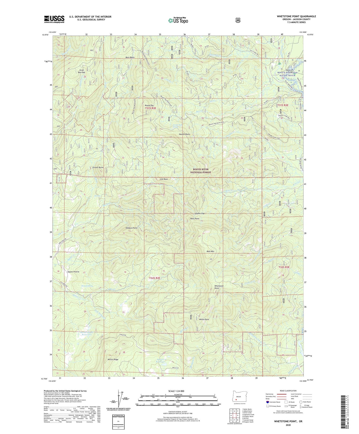
2020 topographic map quadrangle Whetstone Point in the state of Oregon. Scale: 1:24000. Based on the newly updated USGS 7.5' US Topo map series, this map is in the following counties: Jackson. The map contains contour data, water features, and other items you are used to seeing on USGS maps, but also has updated roads and other features. This is the next generation of topographic maps. Printed on high-quality waterproof paper with UV fade-resistant inks.
Quads adjacent to this one:
West: Sugarpine Creek
Northwest: Butler Butte
North: Abbott Butte
Northeast: Union Creek
East: Prospect North
Southeast: Prospect South
South: Cascade Gorge
Southwest: McLeod
Contains the following named places: Abbott Creek, Al Sarena Buzzard Mine, Alder Creek, Applegate Ford, Art Moore Ranch, Ash Homestead, Bald Mountain, Bald Mountain Lookout, Bassett Reservoir, Brush Creek, Buck Basin, Cedar Creek, Cold Spring Creek, Elk Lick, Gravel Butte, Grub Box Gap, Halls Cabin, Halls Point, Halls Point Lookout, Hibbard Point, Hop Creek, Jim Creek, Lick Rock, Littlemile Creek, Lusby Cabin, Matthews Guard Station, Morgan Spring, Needle Rock Spring, Needle Rock Spring Camp, Needle Rocks, P P & L Canal, Persist, Persist Post Office, Persist Ranch, Persist Ranch Reservoirs, Round Top, Sandoz Gap, Schoolma'am Creek, Squaw Prairie, Sunny Camp, Top Creek, Turner Drop, Ulrich Ranch, Whetstone Point, White Point, White Point Lookout, Willits Ridge, Woodruff Bridge, Woodruff Bridge Recreation Site


