MyTopo
Yellowstone Mountain Oregon US Topo Map
Couldn't load pickup availability
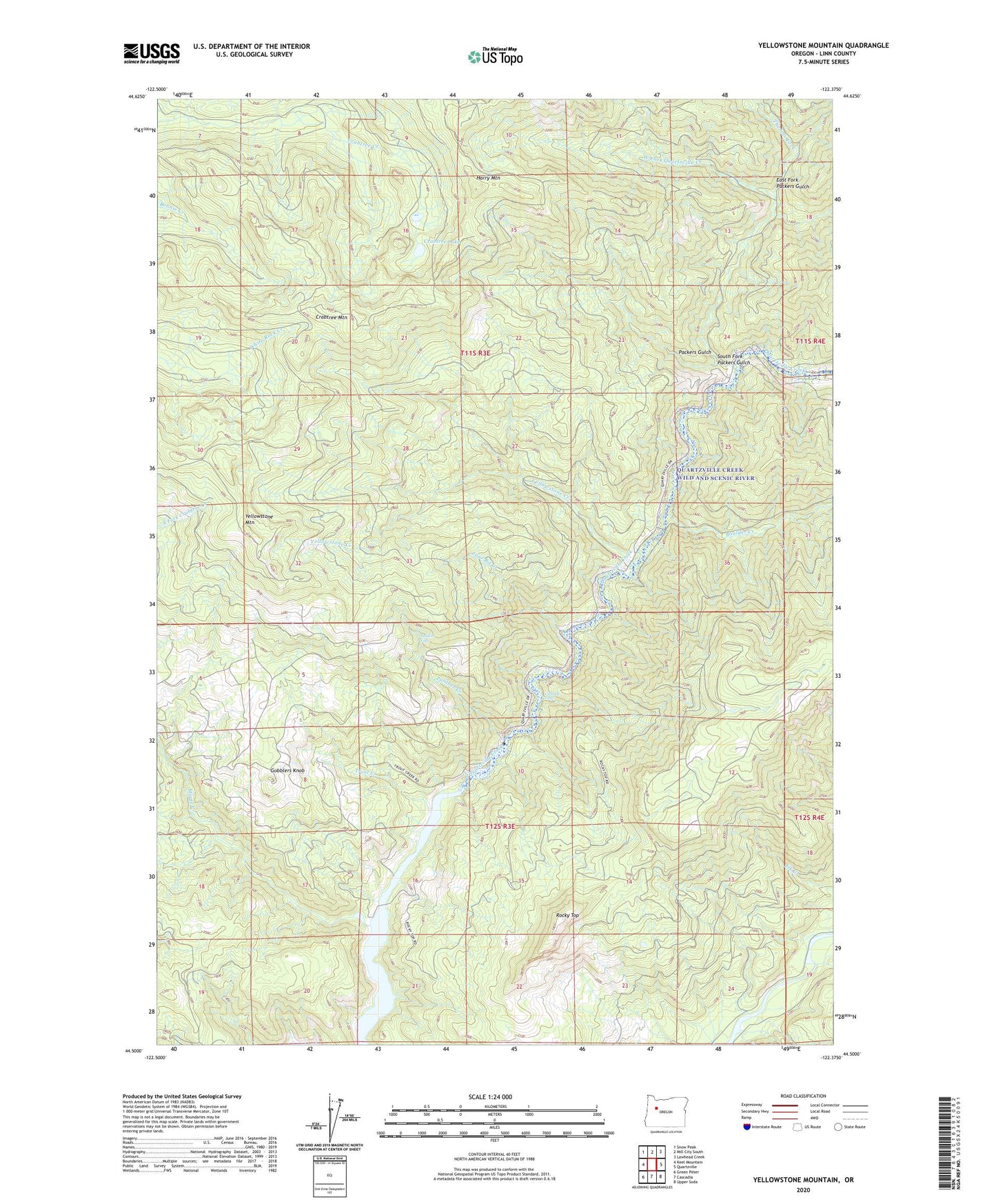
2020 topographic map quadrangle Yellowstone Mountain in the state of Oregon. Scale: 1:24000. Based on the newly updated USGS 7.5' US Topo map series, this map is in the following counties: Linn. The map contains contour data, water features, and other items you are used to seeing on USGS maps, but also has updated roads and other features. This is the next generation of topographic maps. Printed on high-quality waterproof paper with UV fade-resistant inks.
Quads adjacent to this one:
West: Keel Mountain
Northwest: Snow Peak
North: Mill City South
Northeast: Lawhead Creek
East: Quartzville
Southeast: Upper Soda
South: Cascadia
Southwest: Green Peter
Contains the following named places: Anidem, Anidem Post Office, Boulder Creek, Camp Creek, Cascade Falls, Cave Creek, Crabtree Lake, Crabtree Mountain, Dogwood Recreation Site, East Fork Packers Gulch, Four Bit Creek, Gobblers Knob, Harry Mountain, Moose Creek, Packers Gulch, Painter Falls, Panther Creek, Quartzville Creek Wild and Scenic River, Rhody Creek, Rocky Top, South Fork Packers Gulch, Thomas Fork, Trout Creek, West Fork Quartzville Creek, Yellowstone Creek, Yellowstone Guard Station, Yellowstone Mountain