MyTopo
Keel Mountain Oregon US Topo Map
Couldn't load pickup availability
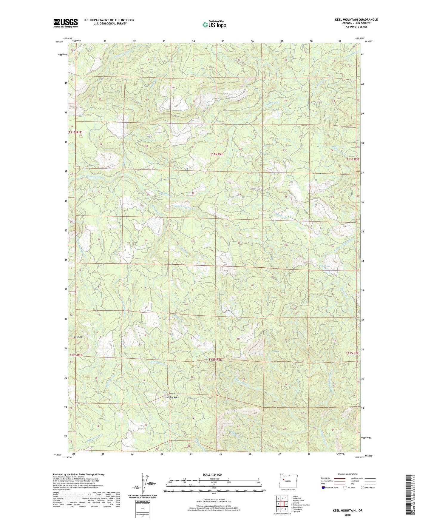
2023 topographic map quadrangle Keel Mountain in the state of Oregon. Scale: 1:24000. Based on the newly updated USGS 7.5' US Topo map series, this map is in the following counties: Linn. The map contains contour data, water features, and other items you are used to seeing on USGS maps, but also has updated roads and other features. This is the next generation of topographic maps. Printed on high-quality waterproof paper with UV fade-resistant inks.
Quads adjacent to this one:
West: Lacomb
Northwest: Jordan
North: Snow Peak
Northeast: Mill City South
East: Yellowstone Mountain
Southeast: Cascadia
South: Green Peter
Southwest: Sweet Home
This map covers the same area as the classic USGS quad with code o44122e5.
Contains the following named places: Bald Barney Creek, Bald Peter Creek, Billy Lake, Bonnie Creek, Camp Creek, Cruiser Creek, Dorgan Creek, East Fork Whitcomb Creek, Keel Mountain, Lost Dog Rock, Rock Creek, Snow Peak Camp, South Fork Crabtree Creek, West Fork Rock Creek, White Rock Creek