MyTopo
Green Peter Oregon US Topo Map
Couldn't load pickup availability
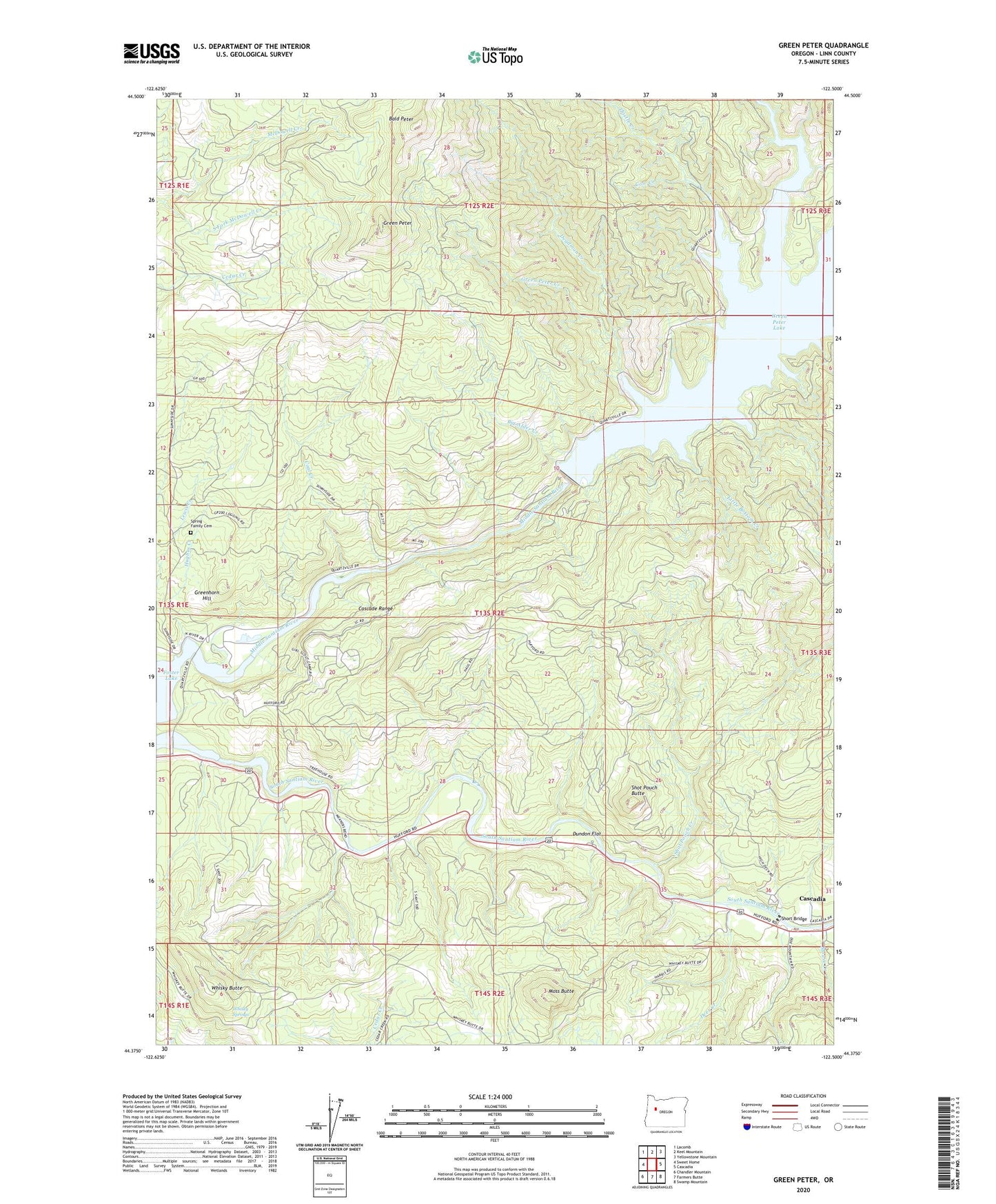
2024 topographic map quadrangle Green Peter in the state of Oregon. Scale: 1:24000. Based on the newly updated USGS 7.5' US Topo map series, this map is in the following counties: Linn. The map contains contour data, water features, and other items you are used to seeing on USGS maps, but also has updated roads and other features. This is the next generation of topographic maps. Printed on high-quality waterproof paper with UV fade-resistant inks.
Quads adjacent to this one:
West: Sweet Home
Northwest: Lacomb
North: Keel Mountain
Northeast: Yellowstone Mountain
East: Cascadia
Southeast: Swamp Mountain
South: Farmers Butte
Southwest: Chandler Mountain
This map covers the same area as the classic USGS quad with code o44122d5.
Contains the following named places: Bald Peter, Big Alder Creek, Calkins Park, Cascadia Census Designated Place, Cascadia Ranger Station, Coal Creek, Deadman Creek, Deer Creek, Dundon Flat, Green Peter, Green Peter Creek, Green Peter Dam, Greenhorn Hill, Hufford Bridge, Hughes Creek, Lewis Creek County Park, Linn County, Little Bottom Creek, Mealey Post Office, Menears Bend Campground, Moss Butte, Mouse Creek, Quartzville Creek, River Bend County Park, River Bend County Park Raft Access, Rumbaugh Creek, Short Bridge, Shot Pouch Butte, Shot Pouch Creek, South Fork McDowell Creek, Spring Family Cemetery, Sunnyside County Park, Sunnyside County Park Boat Ramp, Sunnyside County Park Marina, Sunnyside School, Thistle Creek, Thistle Creek County Park, Thistle Creek County Park Boat Ramp, Whisky Butte, Whisky Springs, Whitcomb Creek, Whitcomb Creek County Park, Whitcomb Creek County Park Boat Ramp, ZIP Code: 97345