MyTopo
Yonna Oregon US Topo Map
Couldn't load pickup availability
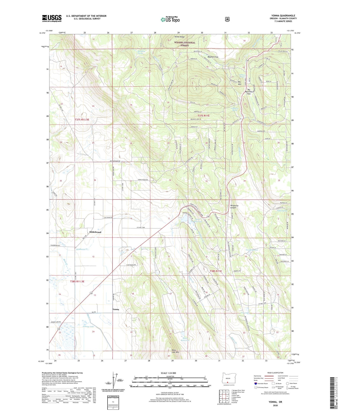
2020 topographic map quadrangle Yonna in the state of Oregon. Scale: 1:24000. Based on the newly updated USGS 7.5' US Topo map series, this map is in the following counties: Klamath. The map contains contour data, water features, and other items you are used to seeing on USGS maps, but also has updated roads and other features. This is the next generation of topographic maps. Printed on high-quality waterproof paper with UV fade-resistant inks.
Quads adjacent to this one:
West: Swan Lake
Northwest: Sprague River West
North: Sprague River East
Northeast: Beatty
East: Yainax Butte
Southeast: Lorella
South: Bonanza
Southwest: Dairy
Contains the following named places: Bly Mountain, Bly Mountain Pass, Boundary Spring, Calohan Spring, Cox Reservoir, Fisher Creek, Hildebrand, Hildebrand Post Office, Hildebrand Station, Indian Spring, Johnny Lake, Klamath Falls-Lakeview Forest State Park, Kodiac, Kodiak Pond, Log Lake, Maynard Flat, Ritter Reservoir, Schonchin Cinder Pit, Wildhorse Canyon, Wildhorse Creek, Wildhorse Spring, Yonna, Yonna Post Office