MyTopo
Aughwick Pennsylvania US Topo Map
Couldn't load pickup availability
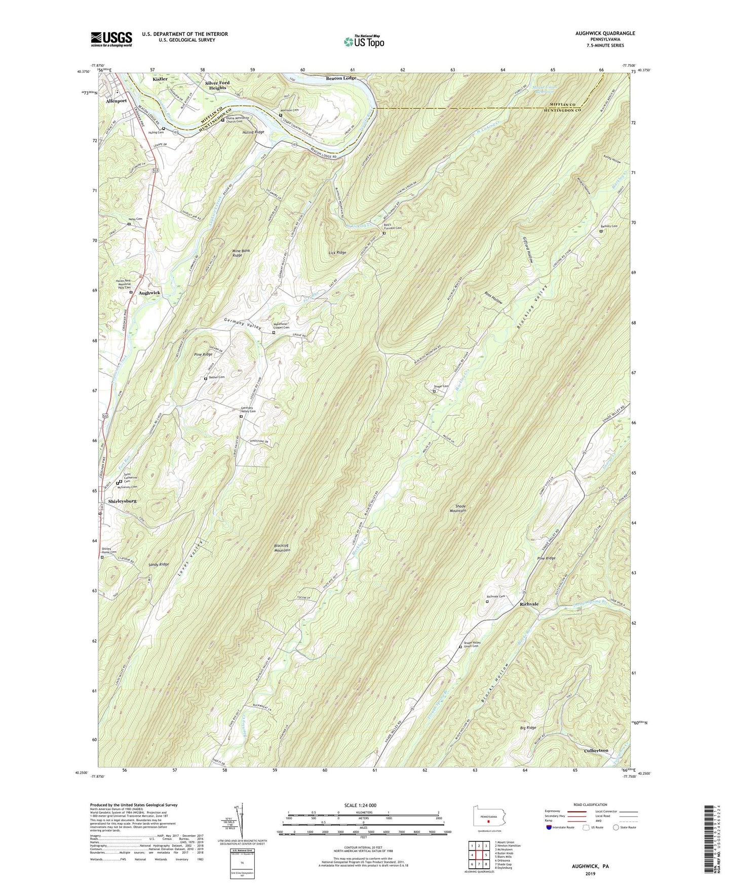
2019 topographic map quadrangle Aughwick in the state of Pennsylvania. Scale: 1:24000. Based on the newly updated USGS 7.5' US Topo map series, this map is in the following counties: Huntingdon, Mifflin, Juniata. The map contains contour data, water features, and other items you are used to seeing on USGS maps, but also has updated roads and other features. This is the next generation of topographic maps. Printed on high-quality waterproof paper with UV fade-resistant inks.
Quads adjacent to this one:
West: Butler Knob
Northwest: Mount Union
North: Newton Hamilton
Northeast: McVeytown
East: Blairs Mills
Southeast: Doylesburg
South: Shade Gap
Southwest: Orbisonia
Contains the following named places: Adams, Allenport, Allenport Census Designated Place, American Legion Country Club, Anthill Trail, Aughwick, Aughwick Creek, Barkley Cemetery, Beacon Lodge, Bell's Furnace Cemetery, Bethel Cemetery, Bible to Youth Camp, Big Ridge, Blocks Hollow, Blocks Run, County Line Picnic Area, Culbertson, Fair Oak School, Germany Valley, Germany Valley Cemetery, Gifford Hollow, Gluck School, Haven Rest Memorial Park Cemetery, Huling Cemetery, Huling Ridge, Kelley Hollow, Lick Ridge, Little Rock School, Loves Valley, McGarvey Cemetery, Mine Bank Ridge, Morrison Cemetery, Mount Union Reservoir, Nebo Cemetery, Nebo Church, Otelia Church, Otelia Mennonite Church Cemetery, Pine Ridge, Red Hill School, Richvale, Richvale Cemetery, Ross Hollow, Saint Catherine Cemetery, Shade Valley Union Cemetery, Shirley Home Cemetery, Shirley Home for the Aged, Shirleysburg, Shirleysburg Post Office, Shope Cemetery, Stone Church, Sugar Valley, Township of Shirley, Township of Tell, Valley Point, Valley Point Church, Wakefield Chapel Cemetery, West Licking Creek, Wildcat Hollow, Yuling School, ZIP Codes: 17066, 17243