MyTopo
McVeytown Pennsylvania US Topo Map
Couldn't load pickup availability
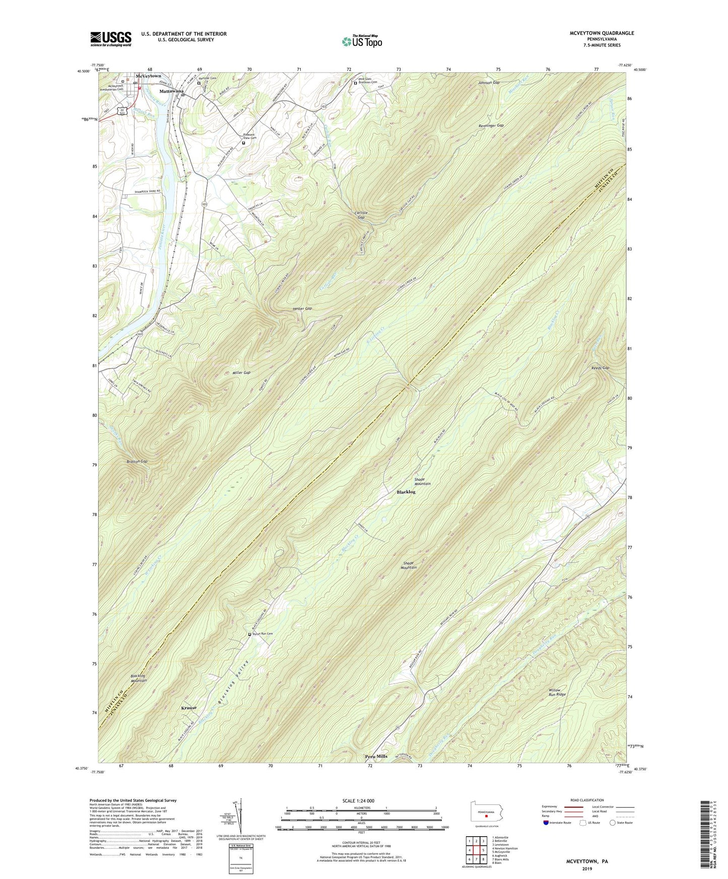
2023 topographic map quadrangle McVeytown in the state of Pennsylvania. Scale: 1:24000. Based on the newly updated USGS 7.5' US Topo map series, this map is in the following counties: Mifflin, Juniata. The map contains contour data, water features, and other items you are used to seeing on USGS maps, but also has updated roads and other features. This is the next generation of topographic maps. Printed on high-quality waterproof paper with UV fade-resistant inks.
Quads adjacent to this one:
West: Newton Hamilton
Northwest: Allensville
North: Belleville
Northeast: Lewistown
East: McCoysville
Southeast: Blain
South: Blairs Mills
Southwest: Aughwick
This map covers the same area as the classic USGS quad with code o40077d6.
Contains the following named places: Blacklog, Blacklog Mountain, Borough of McVeytown, Bratton Gap, Byron Church, Byron Run Cemetery, Carlisle Gap, Carlisle Gap Trail, Flat Trail, Hartzler Cemetery, Hesser Gap, Huffman School, Johnson Gap, Krause, Longfellow Trail, Mattawana, Mattawana Census Designated Place, Mattawana Post Office, McVeytown, McVeytown Ambulance Station 18, McVeytown Post Office, McVeytown Presbyterian Cemetery, McVeytown Volunteer Fire Company Station 18, Miller Gap, Mount Pleasant School, Musser Run, Peru Mills, Pine Glen Brethren Cemetery, Pine Glen Church, Pleasant View Cemetery, Pleasant View School, Reeds Gap, Renninger Gap, Spruce Run, State Game Lands Number 215, Sugar Springs Trail, Township of Bratton, Willow Run Ridge