MyTopo
Avella Pennsylvania US Topo Map
Couldn't load pickup availability
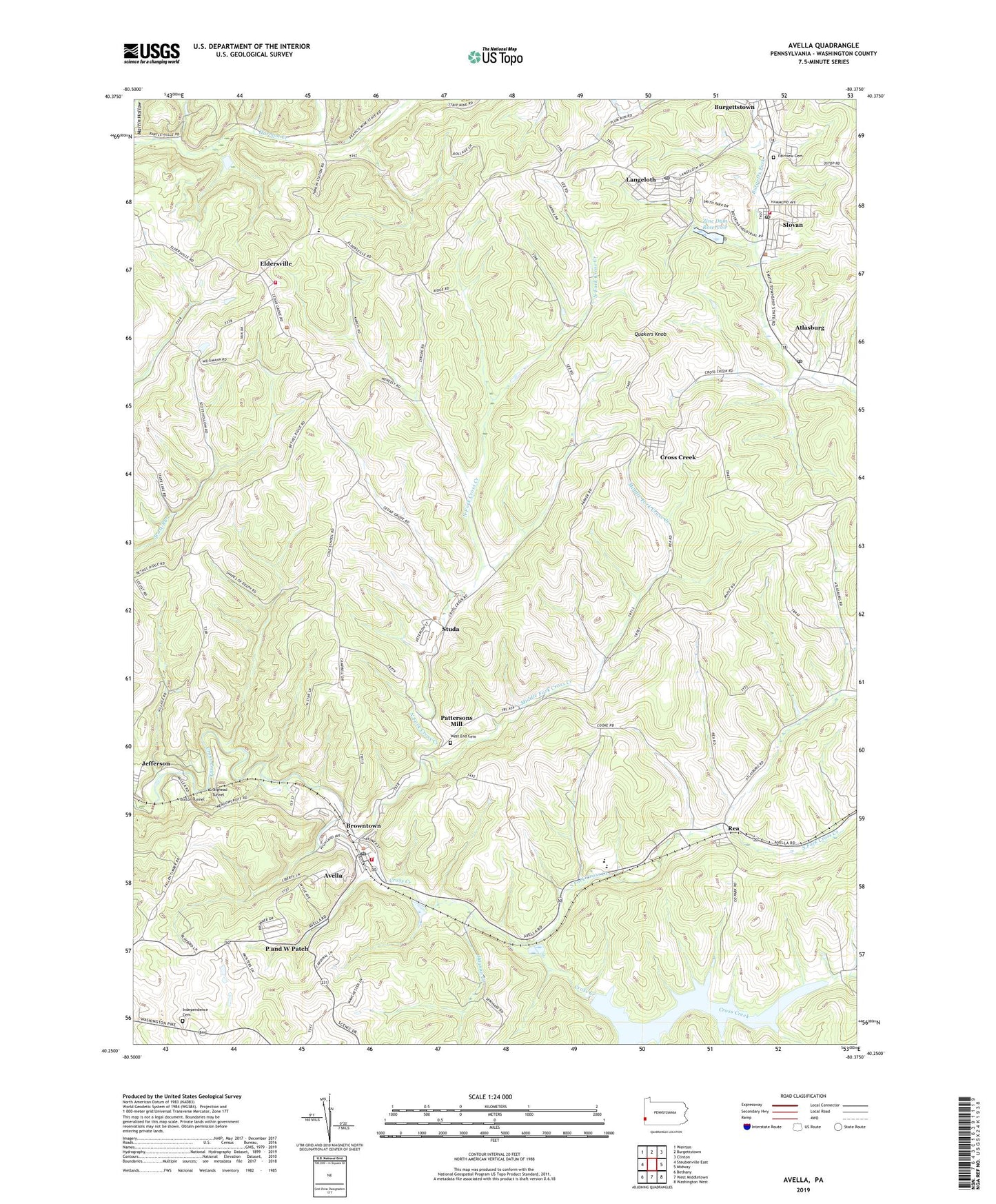
2023 topographic map quadrangle Avella in the state of Pennsylvania. Scale: 1:24000. Based on the newly updated USGS 7.5' US Topo map series, this map is in the following counties: Washington. The map contains contour data, water features, and other items you are used to seeing on USGS maps, but also has updated roads and other features. This is the next generation of topographic maps. Printed on high-quality waterproof paper with UV fade-resistant inks.
Quads adjacent to this one:
Northwest: Weirton
North: Burgettstown
Northeast: Clinton
East: Midway
Southeast: Washington West
South: West Middletown
Southwest: Bethany
This map covers the same area as the classic USGS quad with code o40080c4.
Contains the following named places: Atlasburg, Atlasburg Census Designated Place, Atlasburg Elementary School, Atlasburg Post Office, Avella, Avella Area Junior Senior High School, Avella Census Designated Place, Avella Highlands, Avella Post Office, Avella Volunteer Fire Department Station 35, Bethel Church, Bixton Tunnel, Browntown, Cedar Grove School, Craighead Tunnel, Cross Creek, Cross Creek Census Designated Place, Cross Creek County Park, Eldersville, Eldersville Elementary School, Fairview Cemetery, Flood Dam 485, Grand View Dairy Farm, Hanlin Station, Haynan Creek, Hill Stadium, Independence Cemetery, Independence Township School, Jefferson, Jefferson Township Volunteer Fire Department Station 49, Langeloth, Langeloth Census Designated Place, Langeloth Elementary School, Langeloth Post Office, Meadowcroft, Meadowcroft Rock Shelter, Middle Fork Cross Creek, Mount Calvary Church, North Fork Cross Creek, P and W Patch, PA-479 Dam, Pa-480 Dam, Pa-484 Dam, Pa-485 Dam, Pattersons Mill, Quakers Knob, Rea, Rea Block Field, Saint Johns Church, Slovan, Slovan Census Designated Place, Slovan Post Office, Slovan Volunteer Fire Department, Smith Township Police Department, South Fork Cross Creek, State Game Lands Number 303, Studa, Township of Cross Creek, Township of Jefferson, Ward Run, Washington County Mennonite School, West Middletown, West Point Cemetery, Zinc Dam, Zinc Dam Reservoir, ZIP Codes: 15004, 15054, 15078, 15312