MyTopo
Burgettstown Pennsylvania US Topo Map
Couldn't load pickup availability
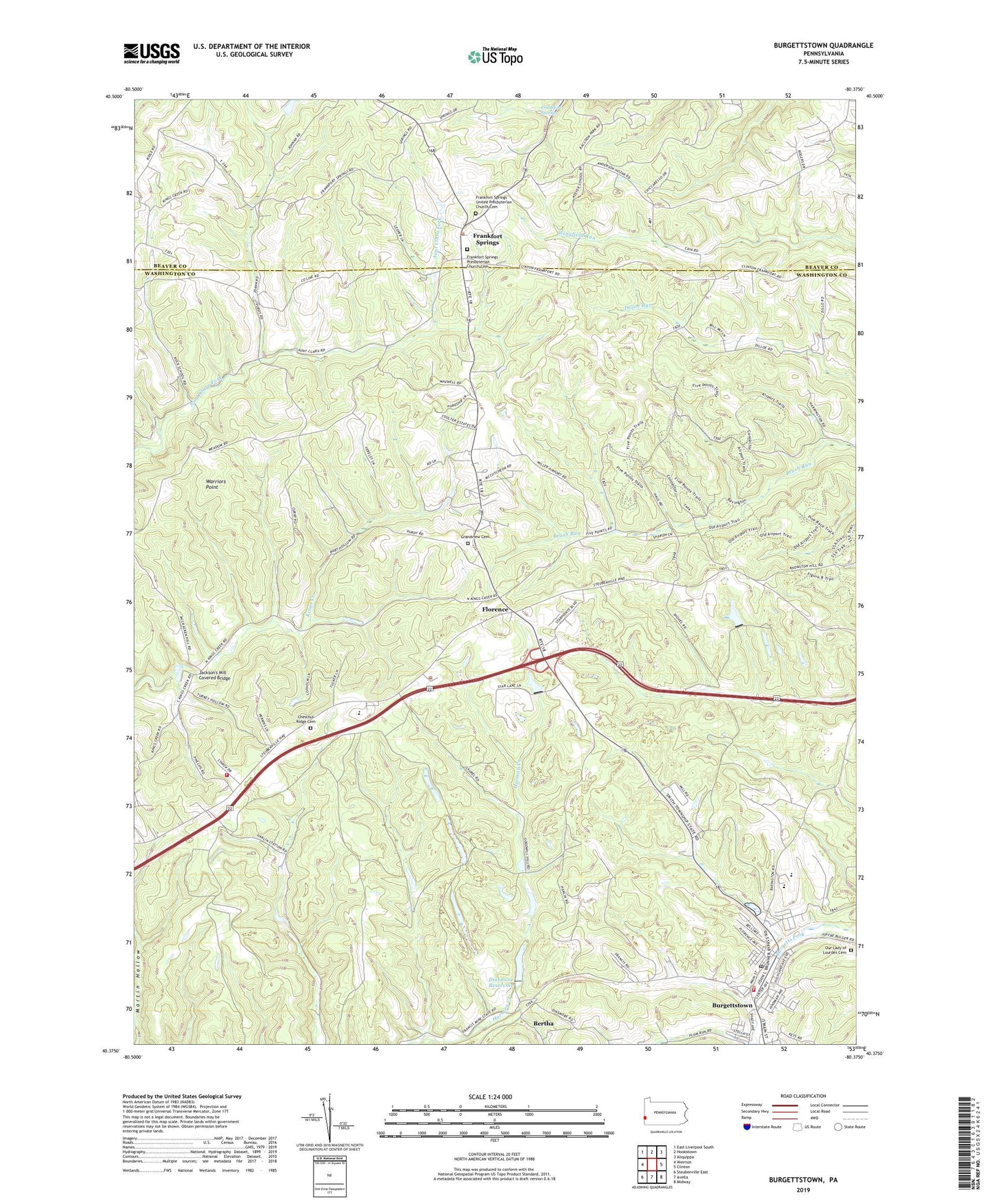
2023 topographic map quadrangle Burgettstown in the state of Pennsylvania. Scale: 1:24000. Based on the newly updated USGS 7.5' US Topo map series, this map is in the following counties: Washington, Beaver. The map contains contour data, water features, and other items you are used to seeing on USGS maps, but also has updated roads and other features. This is the next generation of topographic maps. Printed on high-quality waterproof paper with UV fade-resistant inks.
Quads adjacent to this one:
West: Weirton
North: Hookstown
Northeast: Aliquippa
East: Clinton
Southeast: Midway
South: Avella
This map covers the same area as the classic USGS quad with code o40080d4.
Contains the following named places: Bertha, Bologna Heliport, Borough of Burgettstown, Borough of Frankfort Springs, Burgettstown, Burgettstown Community Library, Burgettstown Community Park, Burgettstown Post Office, Burgettstown Volunteer Fire Company Station 21, Chestnut Ridge Cemetery, Comettsburg, Dinsmore, Dinsmore Reservoir, Dinsmore Storage Number Two Dam, Five Points, Flood Dam 482, Flood Dam 483, Florence, Francis Mine, Frankfort Springs, Frankfort Springs Grange, Frankfort Springs Presbyterian Church Cemetery, Frankfort Springs United Presbyterian Church Cemetery, Grandview Cemetery, Hamilton, Hanover Township School, Hanover Volunteer Fire Department, Jackson's Mill Covered Bridge, Miller Airport, Our Lady of Lourdes Cemetery, Pa-483 Dam, Ponderosa Golflands Golf Course, Purdy, State Game Lands Number 117, Township of Hanover, Tri-State Christian Academy, Tucker Church, Union High School, United Church, Warriors Point, ZIP Code: 15021