MyTopo
Brookland Pennsylvania US Topo Map
Couldn't load pickup availability
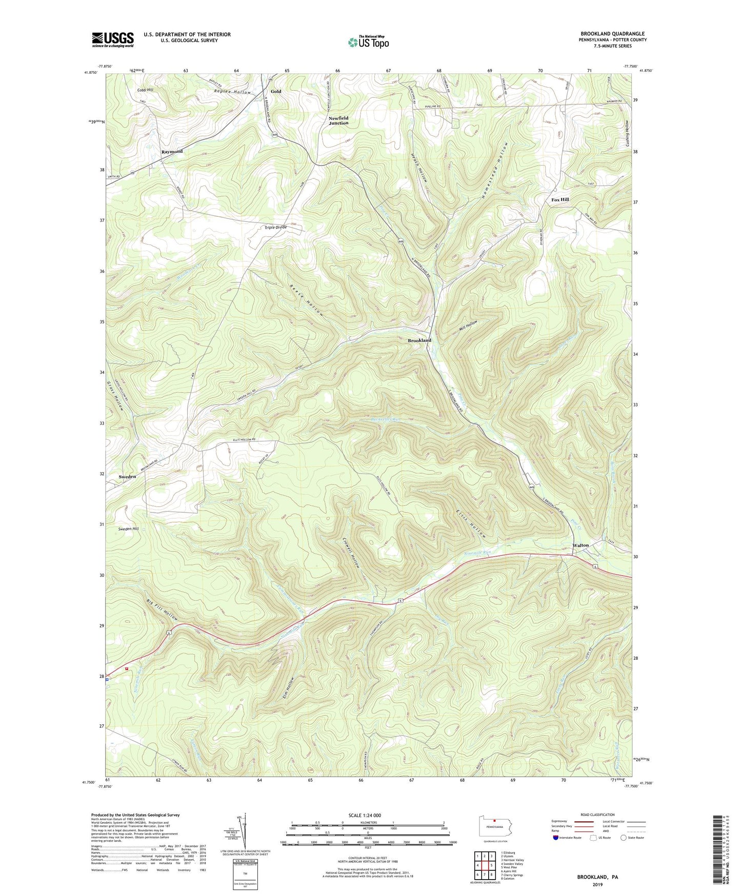
2019 topographic map quadrangle Brookland in the state of Pennsylvania. Scale: 1:24000. Based on the newly updated USGS 7.5' US Topo map series, this map is in the following counties: Potter. The map contains contour data, water features, and other items you are used to seeing on USGS maps, but also has updated roads and other features. This is the next generation of topographic maps. Printed on high-quality waterproof paper with UV fade-resistant inks.
Quads adjacent to this one:
West: Sweden Valley
Northwest: Ellisburg
North: Ulysses
Northeast: Harrison Valley
East: West Pike
Southeast: Galeton
South: Cherry Springs
Southwest: Ayers Hill
Contains the following named places: Barn Brook, Big Fill Hollow, Big Fill Hollow Trail, Brookland, Brown Trail, Buckseller Run, Buckseller Run Trail, Commissioner Run, Commissioner Run Trail, Crowell Hollow, Crowell Hollow Trail, Denton Hill Ski Area, Denton Hill State Park, Dry Run, Ellis Hollow, Elm Hollow, Elm Hollow Trail, Fox Hill, Fox Hill School, Gaffnee Post Office, Gold, Heath Hollow, Homestead Hollow, Jones Run, Losey Trail, Mill Hollow, Newfield Junction, Ninemile Run, Oak Hall School, Pennsylvania Conservation and Natural Resources District 15 Susquehannock, Pennsylvania Lumber Museum, Pennsylvania State Police Troop F Coudersport Station, Potato City Airport, Raplee Hollow, Raymond, Reese Hollow, Ridge Trail, Storey Trail, Sweden, Sweden Hill Church, Township of Ulysses, Township Trail, Triple Divide, Walton, ZIP Code: 16948