MyTopo
Cammal Pennsylvania US Topo Map
Couldn't load pickup availability
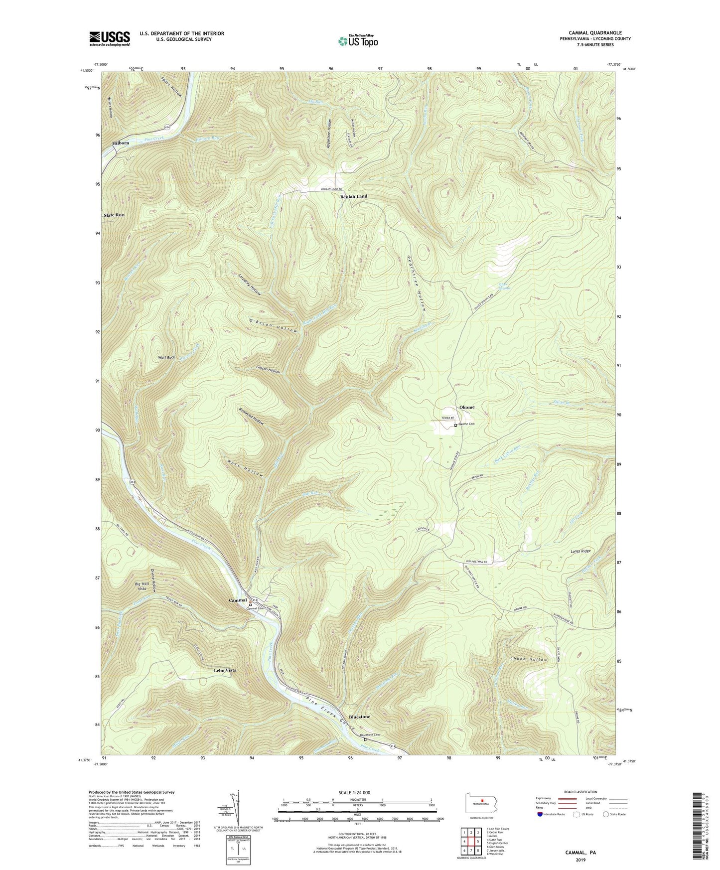
2019 topographic map quadrangle Cammal in the state of Pennsylvania. Scale: 1:24000. Based on the newly updated USGS 7.5' US Topo map series, this map is in the following counties: Lycoming. The map contains contour data, water features, and other items you are used to seeing on USGS maps, but also has updated roads and other features. This is the next generation of topographic maps. Printed on high-quality waterproof paper with UV fade-resistant inks.
Quads adjacent to this one:
West: Slate Run
Northwest: Lee Fire Tower
North: Cedar Run
Northeast: Morris
East: English Center
Southeast: Waterville
South: Jersey Mills
Southwest: Glen Union
Contains the following named places: Appletree Hollow, Bark Cabin Natural Area, Basswood Hollow, Bennys Run, Beulah Land, Big Trail Vista, Bluestone, Bluestone Cemetery, Bluestone Run, Bull Run, Cabin Trail, Cammal, Cammal Cemetery, Cammal Trail, Chubb Hollow, Chubb Trail, Divine Hollow, Dry Run Trail, First Big Fork, Gibson Hollow, Hell Hollow Trail, Herritt Hollow, Hilborn, Hilborn Run, Holt Trail, Jack Hebrit Trail, Lebo Vista, Left Fork Mill Run, Left Fork Miller Run, Mill Run, Miller Run, Monks Hollow, Mullen Run, O'Brian Hollow, Okome, Okome Cemetery, Ott Fork, Peachtree Hollow, Pikes Peak Trail, Pine Creek Independent Volunteer Fire Company, Right Fork Mill Run, Ross Run, Ross Siding, Sam Carson Trail, Sebring Branch, Silver Springs, Solomon Run, Spook Hollow, State Game Lands Number 68, Stradley Hollow, Township of Brown, Township of McHenry, Trout Run, Truman Run, Watson Fork, Watt Hollow, Wildcat Trail, Wolf Rock, Wolf Run, Wolf Run Wild Area, ZIP Codes: 17723, 17739