MyTopo
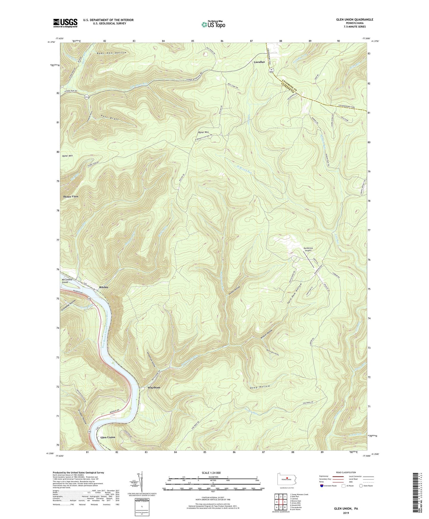
Glen Union Pennsylvania US Topo Map
Couldn't load pickup availability
2023 topographic map quadrangle Glen Union in the state of Pennsylvania. Scale: 1:24000. Based on the newly updated USGS 7.5' US Topo map series, this map is in the following counties: Clinton, Lycoming. The map contains contour data, water features, and other items you are used to seeing on USGS maps, but also has updated roads and other features. This is the next generation of topographic maps. Printed on high-quality waterproof paper with UV fade-resistant inks.
Quads adjacent to this one:
West: Renovo East
Northwest: Young Womans Creek
North: Slate Run
Northeast: Cammal
East: Jersey Mills
Southeast: Lock Haven
South: Farrandsville
Southwest: Howard NW
This map covers the same area as the classic USGS quad with code o41077c5.
Contains the following named places: Bear Pen Hollow, Bear Pen Hollow Trail, Bear Pen Run, Boyer Trail, Campbell Run, Cleveland Hollow, Craig Fork, Cryder Trail, Davis Cabin Hollow, Deep Hollow, East Branch Hyner Run, First Branch Trail, Flat Ridge Trail, Glen Union, Grandpap Hollow, Green Run, Grugan Hollow, Hunter Hollow, Hyner Mountain, Hyner View, Hyner View State Park, Hyner View Trail, Johnson Ferney Trail, Johnson Run, Lick Run Trail, Long Fork, Lucullus, Mill Run, Oak Ridge Trail, Park Line Trail, Poff Trail, Ponderosa Airport, Post Draft, Rattlesnake Run, Ritchie, Ritchie Run, Robbins Run, Robins Ridge Trail, Sinking Spring Trail, Smokestack Hollow, Staver Run, Sugar Camp, Township of Grugan, Twin Dam Hollow, West Branch Lick Run, West Branch Lick Run Trail, Whetham, Whetham Fire Tower, Whetham Tower Trail, Wildcat Hollow