MyTopo
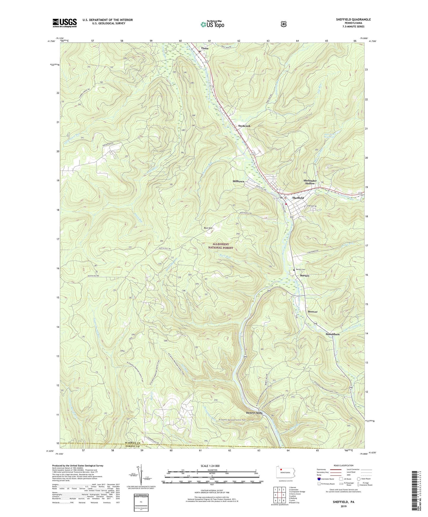
Sheffield Pennsylvania US Topo Map
Couldn't load pickup availability
Also explore the Sheffield Forest Service Topo of this same quad for updated USFS data
2023 topographic map quadrangle Sheffield in the state of Pennsylvania. Scale: 1:24000. Based on the newly updated USGS 7.5' US Topo map series, this map is in the following counties: Warren, Forest. The map contains contour data, water features, and other items you are used to seeing on USGS maps, but also has updated roads and other features. This is the next generation of topographic maps. Printed on high-quality waterproof paper with UV fade-resistant inks.
Quads adjacent to this one:
West: Cherry Grove
Northwest: Warren
North: Clarendon
Northeast: Cornplanter Bridge
East: Ludlow
Southeast: Russell City
South: Lynch
Southwest: Mayburg
This map covers the same area as the classic USGS quad with code o41079f1.
Contains the following named places: Allegheny National Forest, Austin School, Barnes, Barnes Cemetery, Bull Hill, Cherry Grove, Cherry Grove Airport, Deer Lick Reservoir, Deer Lick Run, Dodge Run, Donaldson, Duck Eddy Run, Dunham Run, East Branch Tionesta Creek, Flat Run, Fourmile Run, Henrys Mills, Hoover, Lacey Run, Little Arnot Run, Martin, Martin Run, Mead Run, Messenger Run, Milltown, North Country Trail, Old Sheffield, Pell Run, Rock Run, Saint Pauls Church, Saybrook, Sheffield, Sheffield Census Designated Place, Sheffield Post Office, Sheffield Ranger District Headquarters, Sheffield Station, Sheffield Township Police Department, Sheffield Volunteer Fire Department Station 72, Shelander Hollow, Sixmile Run, South Branch Tionesta Creek, Tiona, Tiona Post Office, Township of Sheffield, Twomile Run, West Branch Tionesta Creek, ZIP Codes: 16313, 16347