MyTopo
Clarendon Pennsylvania US Topo Map
Couldn't load pickup availability
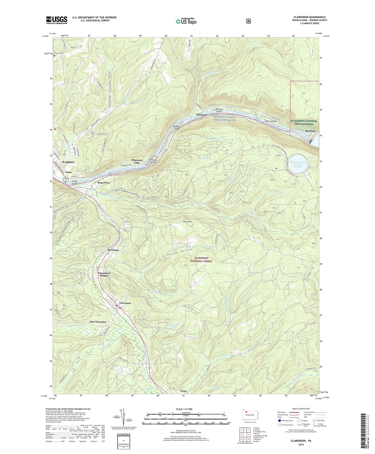
2019 topographic map quadrangle Clarendon in the state of Pennsylvania. Scale: 1:24000. Based on the newly updated USGS 7.5' US Topo map series, this map is in the following counties: Warren. The map contains contour data, water features, and other items you are used to seeing on USGS maps, but also has updated roads and other features. This is the next generation of topographic maps. Printed on high-quality waterproof paper with UV fade-resistant inks.
Quads adjacent to this one:
West: Warren
Northwest: Russell
North: Scandia
Northeast: Cornplanter Run
East: Cornplanter Bridge
Southeast: Ludlow
South: Sheffield
Southwest: Cherry Grove
Contains the following named places: Allegheny National Fish Hatchery, Anderson Run, Arnot Run, Big Bend, Big Bend Recreation Site, Borough of Clarendon, Browns Run, Clarendon, Clarendon Fire Department, Clarendon Heights, Clarendon Post Office, Corps of Engineers Visitor Center, Cranberry Swamp, Dixon Island, Dutchman Run, Farnsworth Branch, Fluent Run, Geers Ferry, Glade, Glade Run, Glade Volunteer Fire Department Station 57, Harmon Island, Hemlock, Hemlock Run, Hook Run, Hooks Ferry, Irvinedale Elementary School, Kinzua Dam, Kinzua Pumped Storage Dam, Knight Island, Lincoln School, Morrison Run, North Clarendon Post Office, North Fork Sixmile Run, Old Clarendon, Pacard Run, Page Hollow, Possum Hollow, Possum Run, Rogertown, Seneca Pumped Storage Reservoir, Shipmans Eddy, Snyder Cemetery, Stone Hill, Stoneham, Township of Glade, Township of Kinzua, Township of Mead, Verbeck Island, Ward Run, Wardwell, Wardwell Island, Washington School, Weldbank, Weldbank Post Office, Wolf Run, ZIP Code: 16352