MyTopo
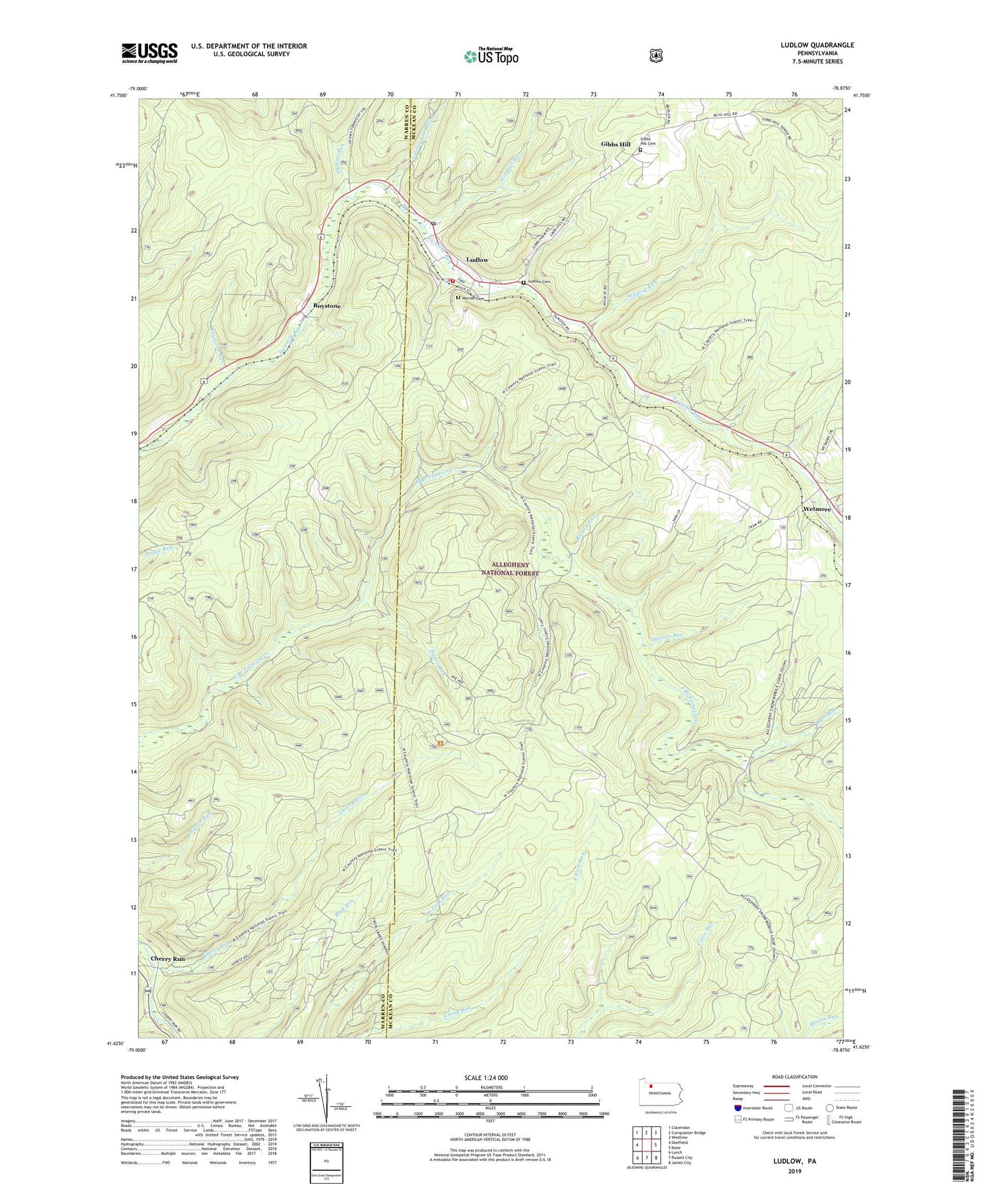
Ludlow Pennsylvania US Topo Map
Couldn't load pickup availability
Also explore the Ludlow Forest Service Topo of this same quad for updated USFS data
2023 topographic map quadrangle Ludlow in the state of Pennsylvania. Scale: 1:24000. Based on the newly updated USGS 7.5' US Topo map series, this map is in the following counties: McKean, Warren. The map contains contour data, water features, and other items you are used to seeing on USGS maps, but also has updated roads and other features. This is the next generation of topographic maps. Printed on high-quality waterproof paper with UV fade-resistant inks.
Quads adjacent to this one:
West: Sheffield
Northwest: Clarendon
North: Cornplanter Bridge
Northeast: Westline
East: Kane
Southeast: James City
South: Russell City
Southwest: Lynch
This map covers the same area as the classic USGS quad with code o41078f8.
Contains the following named places: Bloody Run, Cherry Run, County Line Run, Gibbs Hill, Gibbs Hill Cemetery, Hoffman Farm Camp, Ludlow, Ludlow Cemetery, Ludlow Post Office, Ludlow School, Ludlow Volunteer Fire Department - Station 26, Moriah Cemetery, Negro Run, Phillips Run, Pigeon Run, Rock Run, Roystone, Roystone Run, Sheffield Lookout Tower, Thomas Run, Tionesta Natural Area, Tionesta Scenic Area, Wetmore, Wildcat Recreation Site, Wildcat Run, Windfall Run, ZIP Code: 16333