MyTopo
Clifford Pennsylvania US Topo Map
Couldn't load pickup availability
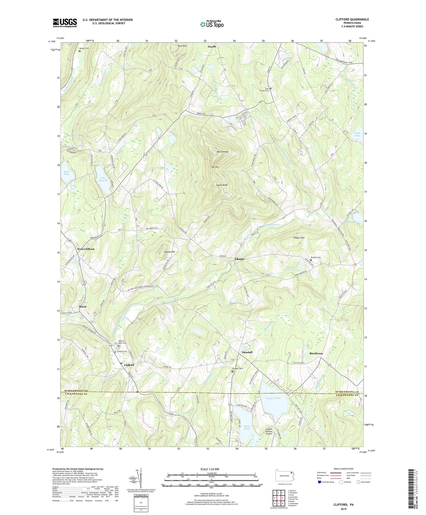
2023 topographic map quadrangle Clifford in the state of Pennsylvania. Scale: 1:24000. Based on the newly updated USGS 7.5' US Topo map series, this map is in the following counties: Susquehanna, Lackawanna. The map contains contour data, water features, and other items you are used to seeing on USGS maps, but also has updated roads and other features. This is the next generation of topographic maps. Printed on high-quality waterproof paper with UV fade-resistant inks.
Quads adjacent to this one:
West: Lenoxville
Northwest: Harford
North: Thompson
Northeast: Orson
East: Forest City
Southeast: Waymart
South: Carbondale
Southwest: Dalton
This map covers the same area as the classic USGS quad with code o41075f5.
Contains the following named places: Bear Swamp, Birchtown, Burdick Cemetery, Burdick Corners, Carbondale-Clifford Airport, Clifford, Clifford Cemetery, Clifford Post Office, Clifford Township Volunteer Fire Company, Cosklos Elkview Airport, Coterell Lake, Coterell Lake Dam, Crystal Lake, Dundaff, Dundaff Cemetery, Dundaff Creek, East Mountain, Elk Hill, Elk Hill Fire Tower, Elk Mountain Ski Center, Elkdale, Elkview Country Club, Idlewild Creek, Lake Idlewild, Lewis Lake, Little Creek, Lyon Street Cemetery, Lyons Street Church, Manzer Cemetery, Mud Pond, Newton Lake, North Knob, Palma, Ross Dam, Ross Lake, Round Hill, Royal, Saint Johns Church, South Knob, Tinker Creek, Tinker Hill, Tinker Hollow, Township of Clifford, Township of Herrick, Welch Hill Church, West Clifford, Willow View Cemetery, ZIP Codes: 18413, 18441, 18470, 18842