MyTopo
Wharton Pennsylvania US Topo Map
Couldn't load pickup availability
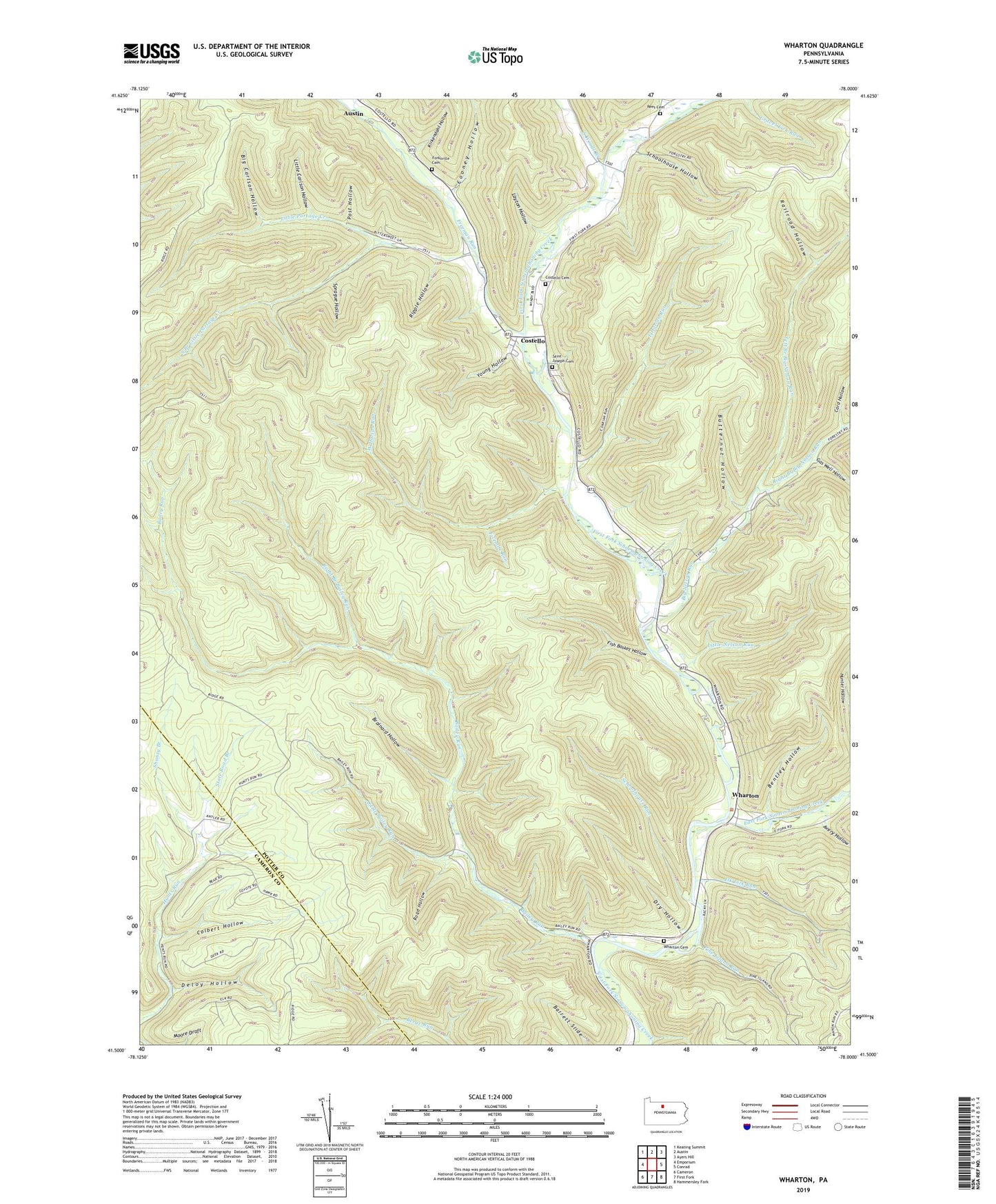
2023 topographic map quadrangle Wharton in the state of Pennsylvania. Scale: 1:24000. Based on the newly updated USGS 7.5' US Topo map series, this map is in the following counties: Potter, Cameron. The map contains contour data, water features, and other items you are used to seeing on USGS maps, but also has updated roads and other features. This is the next generation of topographic maps. Printed on high-quality waterproof paper with UV fade-resistant inks.
Quads adjacent to this one:
West: Emporium
Northwest: Keating Summit
North: Austin
Northeast: Ayers Hill
East: Conrad
Southeast: Hammersley Fork
South: First Fork
Southwest: Cameron
This map covers the same area as the classic USGS quad with code o41078e1.
Contains the following named places: Avery Hollow, Bailey Run, Bentley Hollow, Big Carlson Hollow, Big Nelson Run, Brainard Hollow, Butternut Hollow, Card Hollow, Colbert Hollow, Cooney Hollow, Costello, Costello Cemetery, Deloy Hollow, Dry Hollow, East Darian Run, East Fork Sinnemahoning Creek, Elevenmile Hollow, Elk Lick Run, Fish Basket Hollow, Forest Hill Cemetery, Freeman Run, Garretson Hollow, Gas Well Hollow, Kirkendahl Hollow, Layton Hollow, Left Branch Big Nelson Run, Little Bailey Run, Little Carlson Hollow, Little Nelson Run, Little Portage Creek, Pine Island Run, Post Hollow, Railroad Hollow, Reeseville Cemetery, Reesville School, Right Branch Bailey Run, Right Branch Big Nelson Run, Ripple Hollow, Road Hollow, Saint Augustine - Saint Paul Cemetery, Schoolhouse Hollow, Schoolhouse Run, Shanty Branch, South Branch Little Portage Creek, South Woods Branch, Splash Dam, Sprague Hollow, State Road Branch, Township of Sylvania, West Darian Run, Wharton, Wharton Cemetery, Young Hollow, ZIP Code: 16720