MyTopo
First Fork Pennsylvania US Topo Map
Couldn't load pickup availability
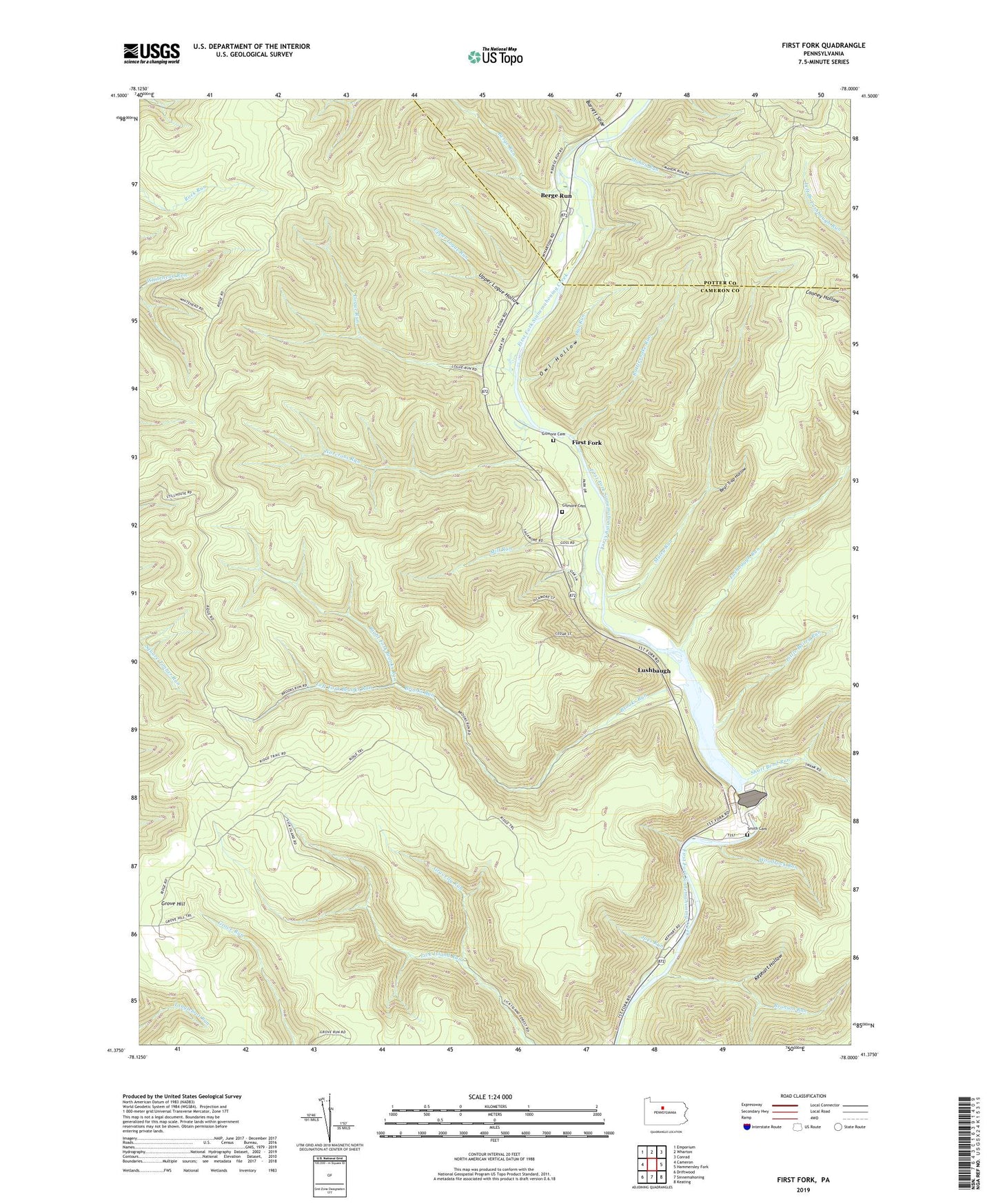
2023 topographic map quadrangle First Fork in the state of Pennsylvania. Scale: 1:24000. Based on the newly updated USGS 7.5' US Topo map series, this map is in the following counties: Cameron, Potter. The map contains contour data, water features, and other items you are used to seeing on USGS maps, but also has updated roads and other features. This is the next generation of topographic maps. Printed on high-quality waterproof paper with UV fade-resistant inks.
Quads adjacent to this one:
West: Cameron
Northwest: Emporium
North: Wharton
Northeast: Conrad
East: Hammersley Fork
Southeast: Keating
South: Sinnemahoning
Southwest: Driftwood
This map covers the same area as the classic USGS quad with code o41078d1.
Contains the following named places: Barrett Slide, Bear Trap Hollow, Berge Run, Bronson Run, Brooks Firetower, Brooks Run, First Fork, First Fork School, George B Stevenson Dam, George B Stevenson Reservoir, Gilmore Cemetery, Gravelly Run, Joes Run, Kephart Hollow, Left Fork Brooks Run, Little Bailey Run, Logue Run, Lushbaugh, Lushbaugh Run, Mahon Run, Mill Run, Muley Run, Norcross Run, Owl Hollow, Owl Run, Rattlesnake Run, Right Fork Brooks Run, Roaring Run, Short Bend Run, Sinnemahoning State Park, Smith Cemetery, Township of Grove, Upper Logue Hollow, Upper Logue Run, Woodrock Run