MyTopo
Tamarack Pennsylvania US Topo Map
Couldn't load pickup availability
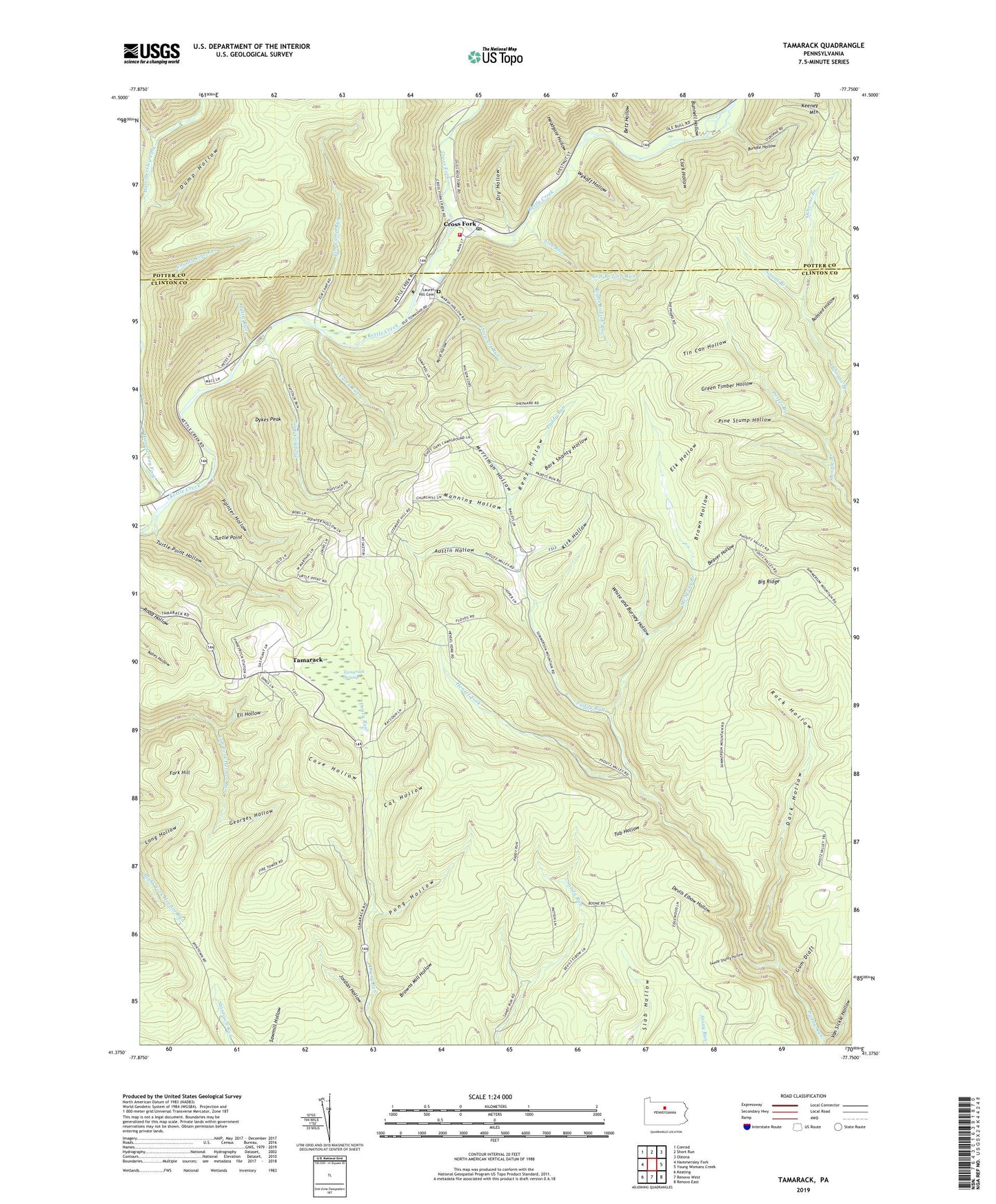
2023 topographic map quadrangle Tamarack in the state of Pennsylvania. Scale: 1:24000. Based on the newly updated USGS 7.5' US Topo map series, this map is in the following counties: Clinton, Potter. The map contains contour data, water features, and other items you are used to seeing on USGS maps, but also has updated roads and other features. This is the next generation of topographic maps. Printed on high-quality waterproof paper with UV fade-resistant inks.
Quads adjacent to this one:
West: Hammersley Fork
Northwest: Conrad
North: Short Run
Northeast: Oleona
East: Young Womans Creek
Southeast: Renovo East
South: Renovo West
Southwest: Keating
This map covers the same area as the classic USGS quad with code o41077d7.
Contains the following named places: Austin Hollow, Bark Shanty Hollow, Beaver Hollow, Betz Hollow, Big Ridge, Big Ridge Trail, Bobsled Hollow, Boone Road Trail, Boundary Line Trail, Brown Hollow, Browns Mill Hollow, Bundle Hollow, Bunnell Hollow, Cal Hollow, Carey Run, Clark Hollow, Cove Hollow, Cow Run, Cross Fork, Cross Fork Post Office, Dark Hollow, Dark Hollow Trail, Devils Elbow Hollow, Drury Ridge Trail, Dry Hollow, Dump Hollow, Dykes Peak, Eli Hollow, Elk Hollow, Elk Hollow Trail, Elm Camp Run, Fork Hill, Georges Hollow, Ginseng Hollow Trail, Green Timber Hollow, Gum Draft, Hammersley Fork, Headgate Hollow, Hensel Fork, Hogstock Run, Jordan Hollow, Jordan Hollow Trail, Kettle Creek Ambulance Association, Kettle Creek Hose Company Station 26, Kirk Hollow, Laurel Hill Cemetery, Left Branch Lieb Run, Left Fork Trail, Leib Run Trail, Lieb Run, Manning Hollow, Marsh Hollow, Marsh Hollow Trail, McNerny Branch, Merriman Hollow, Oak Ridge Trail, Osborne Branch, Painter Hollow, Pfoutz Valley Trail, Pine Stump Hollow, Pong Hollow, Porter Branch, Renz Hollow, Right Branch Lieb Run, Right Fork Hevner Run, Rock Hollow, Rock Hollow Trail, Sandy Ridge Trail, Sandy Trail, Scoval Branch, Shintown Run Trail, Stewart Run, Swede Shanty Hollow, Tamarack, Tamarack Lookout Tower, Tamarack Swamp, Tin Can Hollow, Township of Leidy, Tub Hollow, Tub Trail, Turtle Point, Turtle Point Hollow, Tuttle Run, Van Ripper Trail, Van Sickle Hollow, White and Burney Hollow, Wideview Trail, Wykoff Hollow