
MyTopo
Cornplanter Bridge Pennsylvania US Topo Map
Couldn't load pickup availability
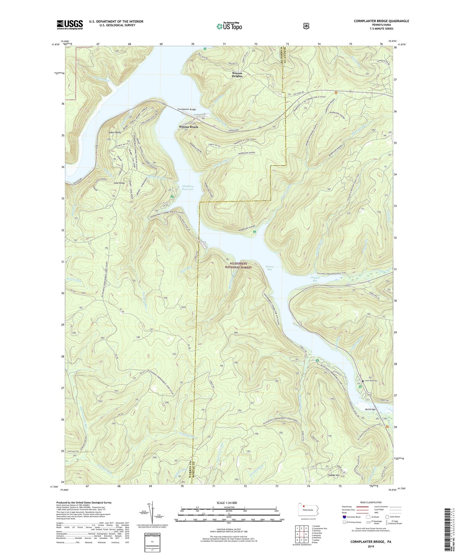
2019 topographic map quadrangle Cornplanter Bridge in the state of Pennsylvania. Scale: 1:24000. Based on the newly updated USGS 7.5' US Topo map series, this map is in the following counties: McKean, Warren. The map contains contour data, water features, and other items you are used to seeing on USGS maps, but also has updated roads and other features. This is the next generation of topographic maps. Printed on high-quality waterproof paper with UV fade-resistant inks.
Quads adjacent to this one:
West: Clarendon
Northwest: Scandia
North: Cornplanter Run
Northeast: Stickney
East: Westline
Southeast: Kane
South: Ludlow
Southwest: Sheffield
Contains the following named places: Bent Run, Bigrock Overflow Area, Briggs Run, Camp Cornplanter, Campbell Mill Interpretive Trail, Campbell Run, Chappel Bay, Chappel Fork, Coal Knob, Coal Knob Lookout Tower, Cornplanter Bridge, Devils Elbow Fishing Site, Dew Drop, Dewdrop, Dewdrop Campground, Dewdrop Run, Dewdrop Trail, Duncle Corners Fishing Area, Dunkle Corners, Dunkle Trail, Dutchman Run, Elijah, Elijah Run, Hemlock Run, Jackson Run, Jakes Rock Picnic Area, Jakes Rocks, Jakes Rocks Overlook, Jakes Run, Kettle Run, Kiasutha Recreational Area, Kinzua, Kinzua Bay, Kinzua Beach, Kinzua Beach Picnic Area, Kinzua Creek, Kinzua Heights, Kinzua Point Information Center, Lightning Run, Lone Pine Cemetery, Longhouse Interprative Trail, Ludlow Trail, Mead Eddy Run, Morrison, Morrison Campground, Morrison Run, Mud Lick Run, North Branch Fourmile Run, Old State Road Campground, Pine Grove Campground, Red Bridge, Red Bridge Bank Fishing Area, Red Bridge Campground, Rimrock Overlook, Rimrock Picnic Area, Rimrock Trail Morrison Trail, Rock Run, South Branch Kinzua Creek, Swede Hill, Township of Hamilton, Tuttle Run, Tuttletown, Wolf Run


