MyTopo
Crosby Pennsylvania US Topo Map
Couldn't load pickup availability
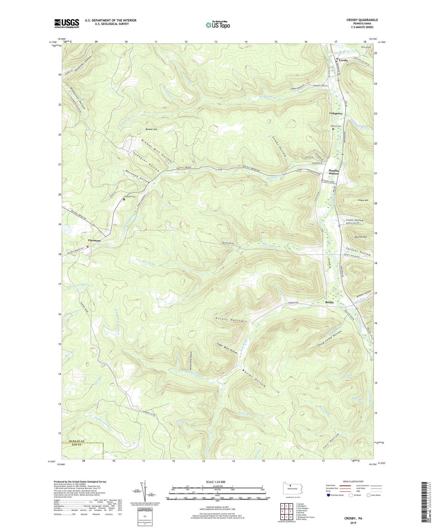
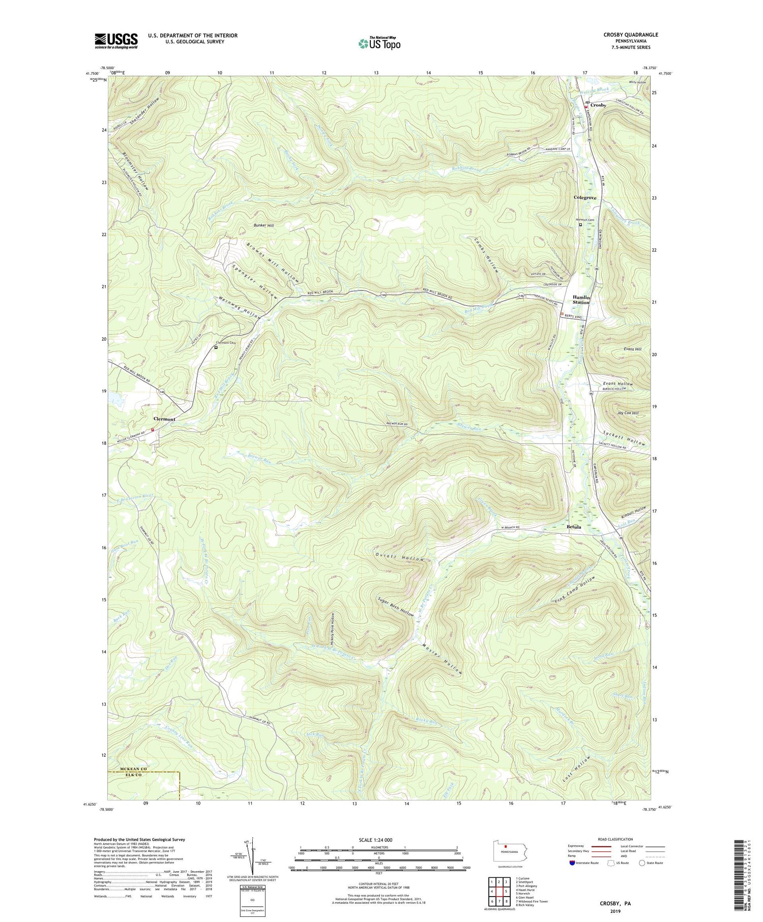
2019 topographic map quadrangle Crosby in the state of Pennsylvania. Scale: 1:24000. Based on the newly updated USGS 7.5' US Topo map series, this map is in the following counties: McKean, Elk. The map contains contour data, water features, and other items you are used to seeing on USGS maps, but also has updated roads and other features. This is the next generation of topographic maps. Printed on high-quality waterproof paper with UV fade-resistant inks.
Quads adjacent to this one:
West: Hazel Hurst
Northwest: Cyclone
North: Smethport
Northeast: Port Allegany
East: Norwich
Southeast: Rich Valley
South: Wildwood Fire Tower
Southwest: Glen Hazel
Contains the following named places: Betula, Brewer Run, Browns Mill Hollow, Bunker Hill, Clermont, Clermont Cemetery, Clermont Volunteer Fire Department Station 14, Cogsdell Brook, Colegrove, Colegrove Brook, Combs Hollow, Crosby, Crosby Post Office, Donley Fork, Evans Hollow, Frog Camp Hollow, Green Brook, Hamlin Station, Hickory Point Hollow, Indian Run, Jay Cox Hill, Kimball Hollow, Lick Run, Long Run, Lost Hollow, Lost Run, Mosier Hollow, Murdock Branch, Norwich Cemetery, Norwich Township Volunteer Fire Department - Station 12, Oviatt Hollow, Pine Run, Red Mill Brook, Robbins Brook, Rocky Fork, Rocky Run, Sackett Hollow, Short Run, South Fork West Branch Potato Creek, Spangler Hollow, Sugar Bush Hollow, Walcott Brook, Wernwag Hollow, West Branch Potato Creek, West Fork West Branch Potato Creek, White Hollow