MyTopo
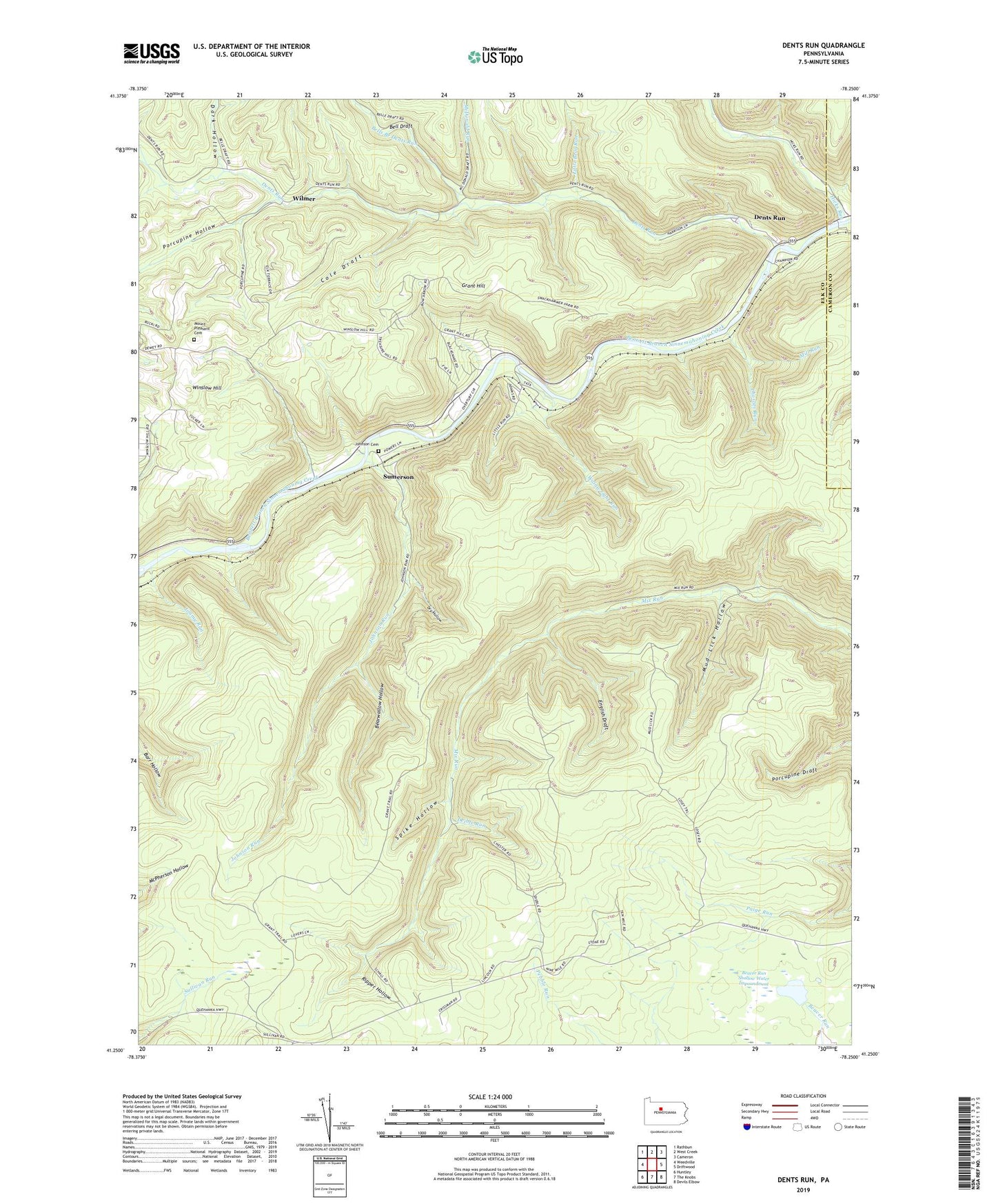
Dents Run Pennsylvania US Topo Map
Couldn't load pickup availability
2023 topographic map quadrangle Dents Run in the state of Pennsylvania. Scale: 1:24000. Based on the newly updated USGS 7.5' US Topo map series, this map is in the following counties: Elk, Cameron. The map contains contour data, water features, and other items you are used to seeing on USGS maps, but also has updated roads and other features. This is the next generation of topographic maps. Printed on high-quality waterproof paper with UV fade-resistant inks.
Quads adjacent to this one:
West: Weedville
Northwest: Rathbun
North: West Creek
Northeast: Cameron
East: Driftwood
Southeast: Devils Elbow
South: The Knobs
Southwest: Huntley
This map covers the same area as the classic USGS quad with code o41078c3.
Contains the following named places: Bearwallow Hollow, Beaver Run Shallow Water Impoundment, Bell Draft, Bells Branch Dents Run, Charlies Run, Cole Draft, Dark Hollow, Deible Run, Dents Run, Dry Hollow, Elk State Forest, English Draft, Grant, Grant Hill, Hicks Run, Hodag Trail, Jimmy Run, Johnson Cemetery, Johnson Church, Johnson Run, Little Bear Run, Marion Brooks Natural Area, McDonald Run, Mount Pleasant Cemetery, Mount Pleasant Church, Mud Lick Hollow, Porcupine Hollow, Quehanna Trail, Quehanna Wild Area, Ripper Hollow, Snooks Trail, Spike Hollow, Stephens Run, Sumerson, Township of Benezette, Wainwright Run, Wilmer, Winslow Hill, ZIP Codes: 15821, 15868