MyTopo
Driftwood Pennsylvania US Topo Map
Couldn't load pickup availability
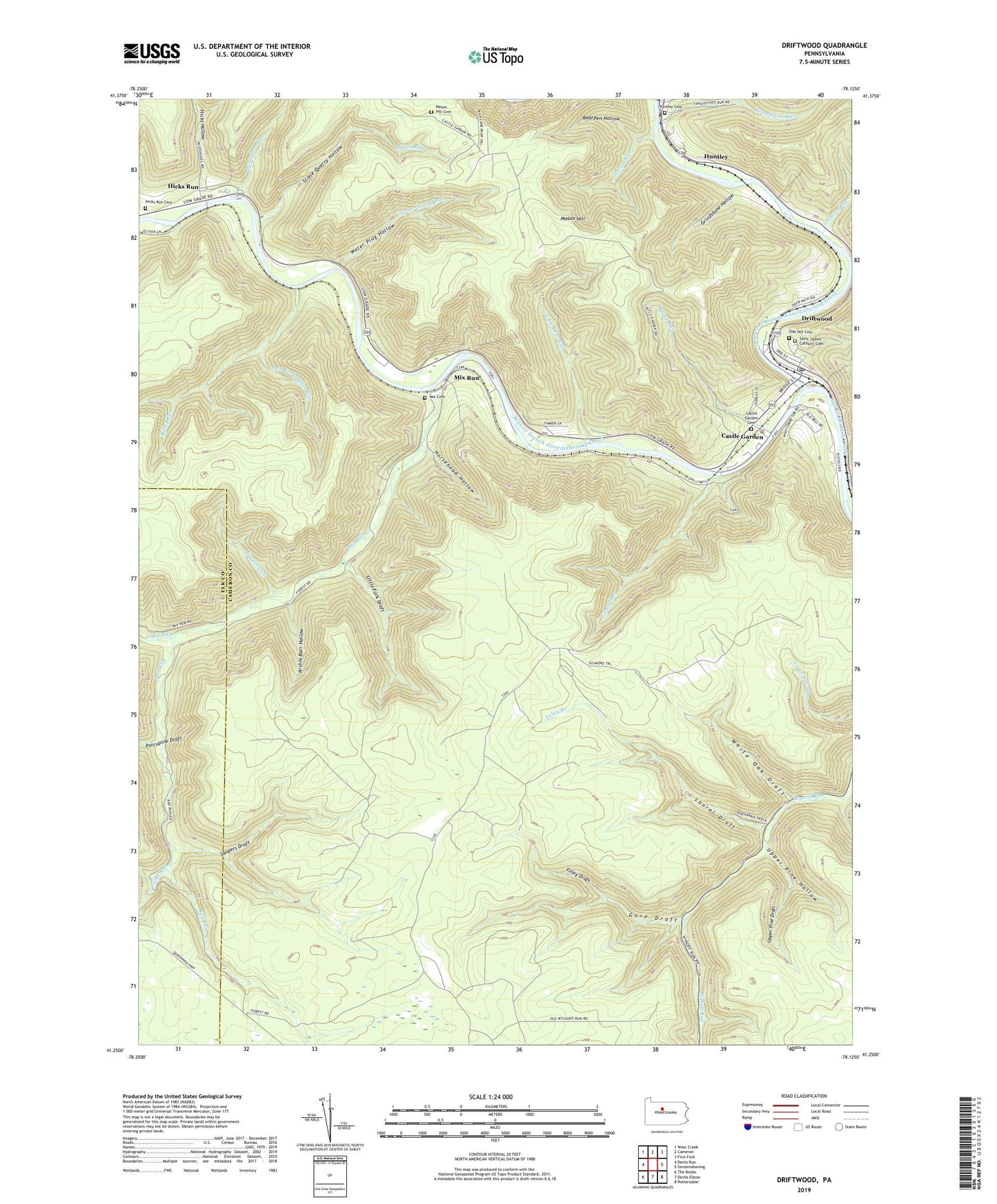
2023 topographic map quadrangle Driftwood in the state of Pennsylvania. Scale: 1:24000. Based on the newly updated USGS 7.5' US Topo map series, this map is in the following counties: Cameron, Elk. The map contains contour data, water features, and other items you are used to seeing on USGS maps, but also has updated roads and other features. This is the next generation of topographic maps. Printed on high-quality waterproof paper with UV fade-resistant inks.
Quads adjacent to this one:
West: Dents Run
Northwest: West Creek
North: Cameron
Northeast: First Fork
East: Sinnemahoning
Southeast: Pottersdale
South: Devils Elbow
Southwest: The Knobs
This map covers the same area as the classic USGS quad with code o41078c2.
Contains the following named places: Archie Barr Hollow, Barrs Run, Bearpen Hollow, Beaverdam Run, Bennett Branch Sinnemahoning Creek, Borough of Driftwood, Boyer Run, Castle Garden, Castle Garden Cemetery, Driftwood, Driftwood Branch Sinnemahoning Creek, Driftwood Post Office, Dry Run, Foley Branch, Foley Draft, Gore Draft, Gravel Lick, Grindstone Hollow, Hicks Hollow, Hicks Run, Hicks Run Cemetery, Horsehead Hollow, Huntley, Huntley Cemetery, Johnson Run, Johnson Run State Forest Natural Area, Laurel Draft, Left Fork Miller Run, Little Dent Run, Little Fork Draft, Lower Pine Run, Mason Hill, Mason Hill Cemetery, Miller Run, Mix Cemetery, Mix Run, Nanny Run, Nelson Run, Oak Hill Cemetery, Paige Run, Porcupine Draft, Red Run, Saint James Catholic Cemetery, Sanders Draft, Stone Quarry Hollow, Stone Quarry Run, Tanglefoot Run, Township of Gibson, Upper Pine Draft, Upper Pine Hollow, Water Plug Hollow, White Oak Draft, ZIP Code: 15832