
MyTopo
Devils Elbow Pennsylvania US Topo Map
Couldn't load pickup availability
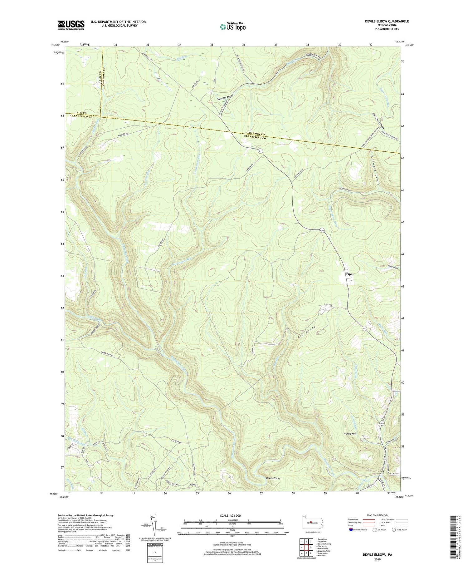
2019 topographic map quadrangle Devils Elbow in the state of Pennsylvania. Scale: 1:24000. Based on the newly updated USGS 7.5' US Topo map series, this map is in the following counties: Clearfield, Cameron, Elk. The map contains contour data, water features, and other items you are used to seeing on USGS maps, but also has updated roads and other features. This is the next generation of topographic maps. Printed on high-quality waterproof paper with UV fade-resistant inks.
Quads adjacent to this one:
West: The Knobs
Northwest: Dents Run
North: Driftwood
Northeast: Sinnemahoning
East: Pottersdale
Southeast: Karthaus
South: Frenchville
Southwest: Lecontes Mills
Contains the following named places: Apollo Rangers Club, Arnold Mountain, Arnold Run, Big Sandy Run, Big Spring Draft, Big Spring Draft Trail, Blackwell Dam, Cherry Hollow Trail, Cole Run, Devils Elbow, Dry Draft, Dutch Hollow, Gifford Run, Grimes Run, Gum Spring Camp, Heichel Run, Lime Spring Camp, Lost Run, Meeker Run, Number Eleven Trail, Number Five Trail, Panther Run, Pine Spring Camp, Piper, Sanders Draft, Schnarr Draft, Susman Run, Township of Covington, Twelvemile Run, Wykoff Run State Forest Natural Area


