MyTopo
Sinnemahoning Pennsylvania US Topo Map
Couldn't load pickup availability
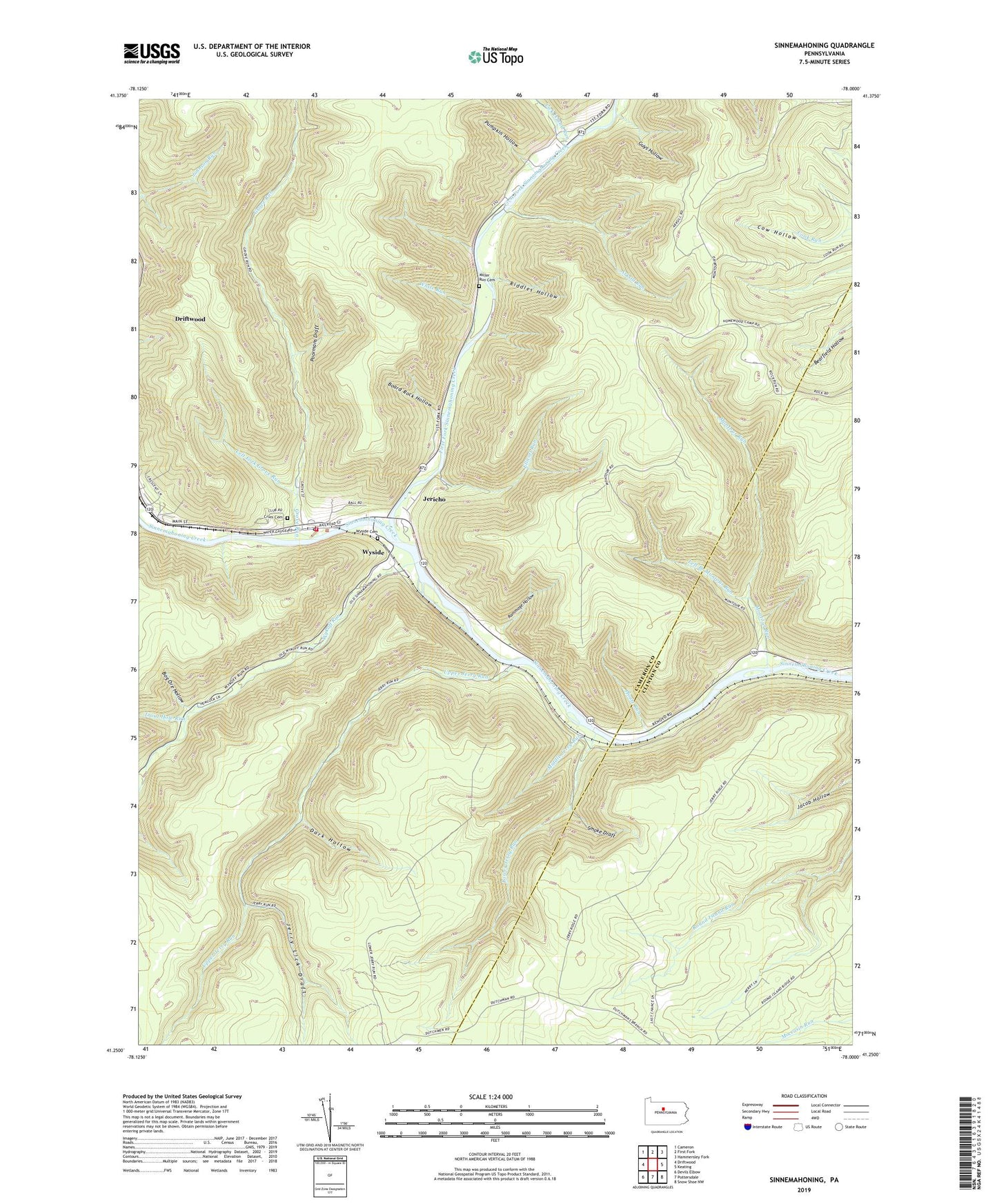
2023 topographic map quadrangle Sinnemahoning in the state of Pennsylvania. Scale: 1:24000. Based on the newly updated USGS 7.5' US Topo map series, this map is in the following counties: Cameron, Clinton. The map contains contour data, water features, and other items you are used to seeing on USGS maps, but also has updated roads and other features. This is the next generation of topographic maps. Printed on high-quality waterproof paper with UV fade-resistant inks.
Quads adjacent to this one:
West: Driftwood
Northwest: Cameron
North: First Fork
Northeast: Hammersley Fork
East: Keating
Southeast: Snow Shoe NW
South: Pottersdale
Southwest: Devils Elbow
This map covers the same area as the classic USGS quad with code o41078c1.
Contains the following named places: Arksill Run, Board Rock Hollow, Bog Ore Hollow, Cow Hollow, Crum Cemetery, Cut Off Trail, Dark Hollow, Ellicott Run, First Fork Sinnemahoning Creek, Grove Run, Guys Hollow, Jericho, Jerry Lick Draft, Left Branch Montour Run, Left Fork Grove Run, Lick Island Run, Lower Jerry Run, Lower Jerry Run Natural Area, Middle Jerry Run, Miller Run Cemetery, Montour Run, North Fork Trail, Pepper Hill Trail, Pepperhill Run, Pfoutz Run, Poormans Draft, Pumpkin Hollow, Quehanna Trail, Quehanna Wild Area, Rammage Hollow, Riddles Hollow, Round Island Run Trail, Sinnamahoning Post Office, Sinnamahoning Volunteer Fire Station 16, Sinnemahoning, Sinnemahoning Post Office, Smoke Draft, Trout Hole Run, Upper Jerry Run, White Oak Run, White Run, Wykoff Run, Wyside, Wyside Cemetery, ZIP Code: 15861