MyTopo
Alexandria Pennsylvania US Topo Map
Couldn't load pickup availability
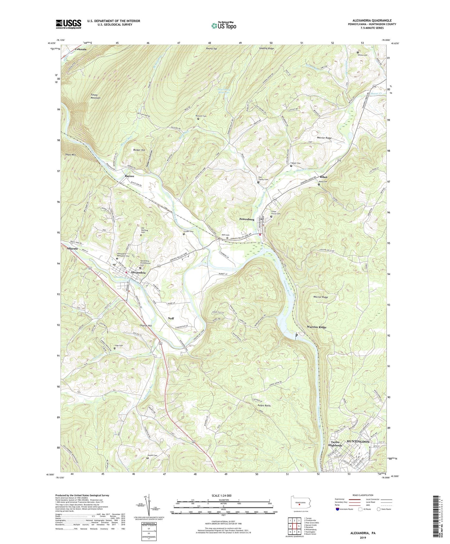
2023 topographic map quadrangle Alexandria in the state of Pennsylvania. Scale: 1:24000. Based on the newly updated USGS 7.5' US Topo map series, this map is in the following counties: Huntingdon. The map contains contour data, water features, and other items you are used to seeing on USGS maps, but also has updated roads and other features. This is the next generation of topographic maps. Printed on high-quality waterproof paper with UV fade-resistant inks.
Quads adjacent to this one:
West: Spruce Creek
Northwest: Tyrone
North: Franklinville
Northeast: Pine Grove Mills
East: Donation
Southeast: Mount Union
South: Huntingdon
Southwest: Williamsburg
This map covers the same area as the classic USGS quad with code o40078e1.
Contains the following named places: Alexandria, Alexandria Methodist Cemetery, Alexandria Post Office, Alexandria Presbyterian Cemetery, Alexandria Volunteer Fire Company Station 1, Alfarata, Aqueduct School, Barree, Bethel Church, Borough of Alexandria, Borough of Petersburg, Bridge School, Bunker Hill, Camp Barree, Cedar Grove Cemetery, Charlie Hill, Cryder Cemetery, Earl Family Cemetery, Emma Creek, Frankstown Branch Juniata River, Huntingdon Area Junior High School, Huntingdon Area Senior High School, Huyett Cemetery, Indian Lookout, Indian Trail, Jackson-Miller Elementary School, Juniata Valley Ambulance Association Company 100, Juniata Valley Elementary School, Juniata Valley High School, Juniata Valley Regional Police Department, Lightner Run, Little Juniata Natural Area, Little Juniata River, Loop Cemetery, Loop School, McGuire Cemetery, McLain Run, Neff, Neff Cemetery, Nelson Run, Old Hartslog Cemetery, Old Petersburg Cemetery, Petersburg, Petersburg Post Office, Petersburg Reservoir, Petersburg Volunteer Fire Company Station 4, Pulpit Rocks, Rainbow Trail, Reed Cemetery, Reeds Run, Ribot, Ridge-Co Heliport, Robinson Run, Round Top, Round Top Trail, Shaver Creek, Short Mountain, Swamp School, Taylor Highlands, Teaberry Hollow, Township of Logan, Township of Porter, Valley School, Warrior Ridge, Warrior Ridge Dam, Weyer Cemetery, Wilson Cemetery, Wilson School, WKVR-FM (Huntingdon), ZIP Code: 16611