MyTopo
Salladasburg Pennsylvania US Topo Map
Couldn't load pickup availability
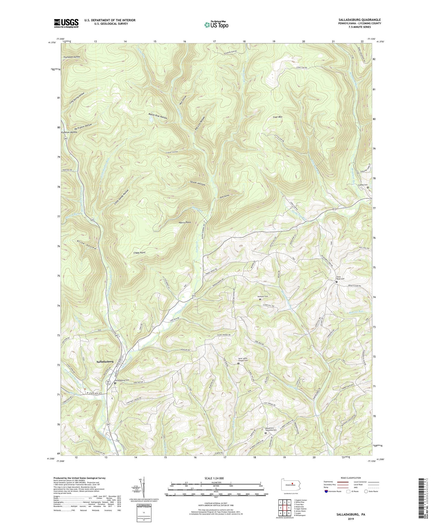
2023 topographic map quadrangle Salladasburg in the state of Pennsylvania. Scale: 1:24000. Based on the newly updated USGS 7.5' US Topo map series, this map is in the following counties: Lycoming. The map contains contour data, water features, and other items you are used to seeing on USGS maps, but also has updated roads and other features. This is the next generation of topographic maps. Printed on high-quality waterproof paper with UV fade-resistant inks.
Quads adjacent to this one:
West: Waterville
Northwest: English Center
North: White Pine
Northeast: Trout Run
East: Cogan Station
Southeast: Williamsport
South: Linden
Southwest: Jersey Shore
This map covers the same area as the classic USGS quad with code o41077c2.
Contains the following named places: Anthony Cemetery, Anthony Church, Borough of Salladasburg, Chestnut Grove School, Citizens Hose Company Substation, Clapp Point, Coal Mountain, Cramer Hollow, De France Hollow, First Fork Larrys Creek, Funston Hollow, Funston Run, Greenwood School, Harbor Run, Harris Point, Jobes Run, Joes Run, Keiss School, Kline Hollow, Little Gap Run, Little Harbor Run, Little Sandy Hollow, Long Run, Ludwig Cemetery, Lumber Bridge School, Lycoming Church, Main Creek School, Mash Run, Match Pine Hollow, Mud Run, Pond Hollow, Pot Lick Hollow, Roaring Run, Saint Johns Chapel Cemetery, Saint Johns Church, Salladasburg, Salladasburg Cemetery, Salladasburg Elementary School, Second Fork Larrys Creek, Spook Hollow, Stablers Grove Picnic Area, State Game Lands Number 114, State Road Cemetery, State Road Church, State Road School, Steam Mill School, Stony Gap Run, Stony Gap School, Township of Anthony, Township of Mifflin, Upper Pine Run School, Watt Hollow, Woodward Township Cemetery