MyTopo
Freeburg Pennsylvania US Topo Map
Couldn't load pickup availability
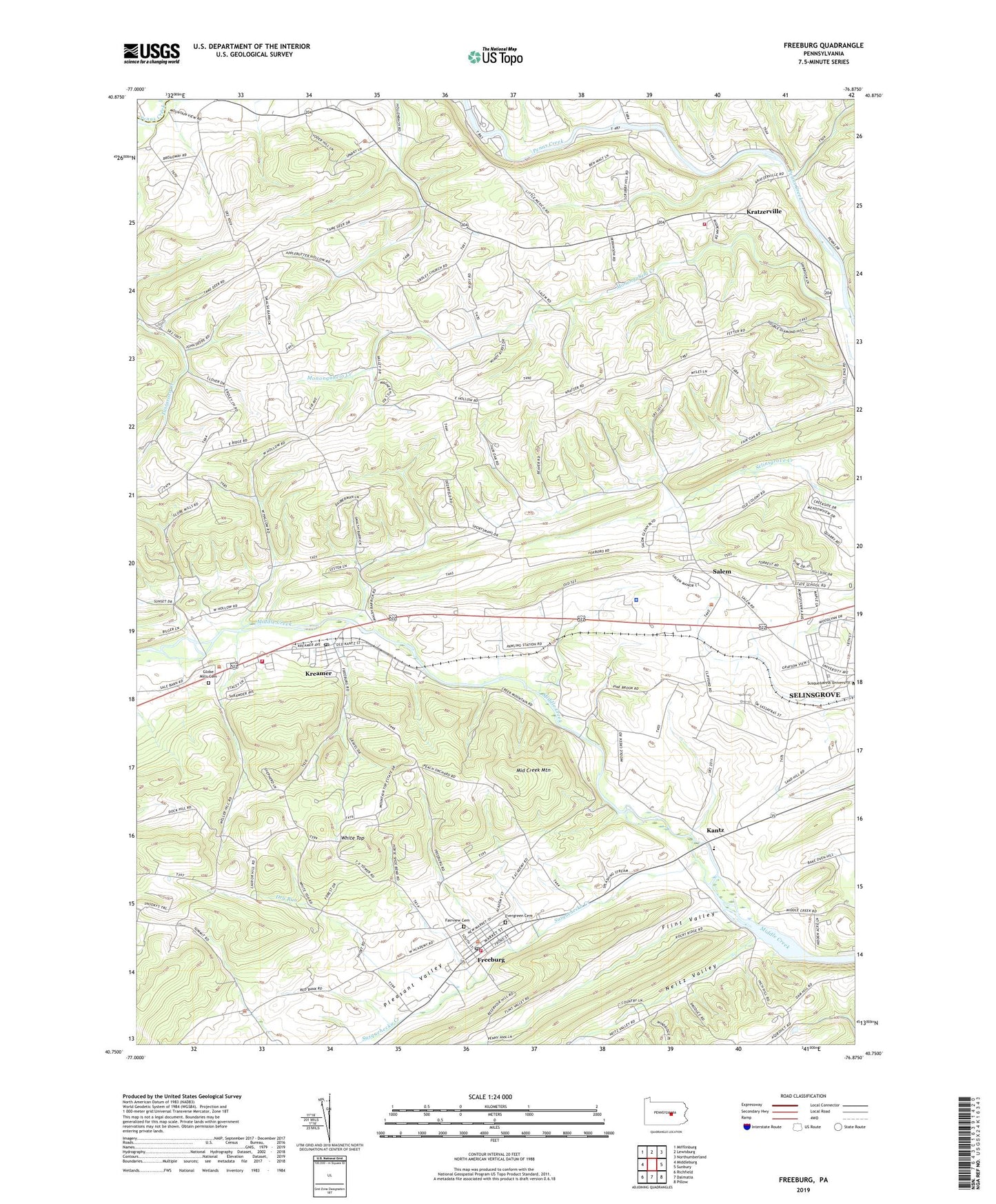
2019 topographic map quadrangle Freeburg in the state of Pennsylvania. Scale: 1:24000. Based on the newly updated USGS 7.5' US Topo map series, this map is in the following counties: Snyder, Union. The map contains contour data, water features, and other items you are used to seeing on USGS maps, but also has updated roads and other features. This is the next generation of topographic maps. Printed on high-quality waterproof paper with UV fade-resistant inks.
Quads adjacent to this one:
West: Middleburg
Northwest: Mifflinburg
North: Lewisburg
Northeast: Northumberland
East: Sunbury
Southeast: Pillow
South: Dalmatia
Southwest: Richfield
Contains the following named places: Aikens Hall, Borough of Freeburg, Brouse School, Clifford Station, Degenstein Campus Center, Dry Run, Evergreen Cemetery, Fairoak School, Fairview Cemetery, Flint Valley, Freeburg, Freeburg Post Office, Freeburg Volunteer Fire Company - Station 30, Freeburg Washington Elementary School, Globe Mills, Globe Mills Cemetery, Hermans School, Hill End School, Isaacs House, Kantz, Kratzerville, Kratzerville Census Designated Place, Kratzerville Volunteer Fire Company Station 130, Kreamer, Kreamer Census Designated Place, Kreamer Post Office, Kreamer Volunteer Fire Company Station 120, Krouses School, Meiser Station, Middle Creek Lake, Middle Creek Mountain, Monongahela Creek, Neitz Valley, Pawling Station, Pennsylvania State Police Troop F Selinsgrove Station, Phi Mu Delta, Pleasant Valley, Saint Pauls Church, Salem, Sassafras Complex, Scholar's House, Selinsgrove State School and Hospital, Snyder School, State Game Lands Number 212, Susquehecka Creek, Theta Chi, Township of Jackson, Township of Middlecreek, Township of Penn, Township of Washington, Weber Chapel Auditorium, White Top, ZIP Codes: 17827, 17870