MyTopo
Fryburg Pennsylvania US Topo Map
Couldn't load pickup availability
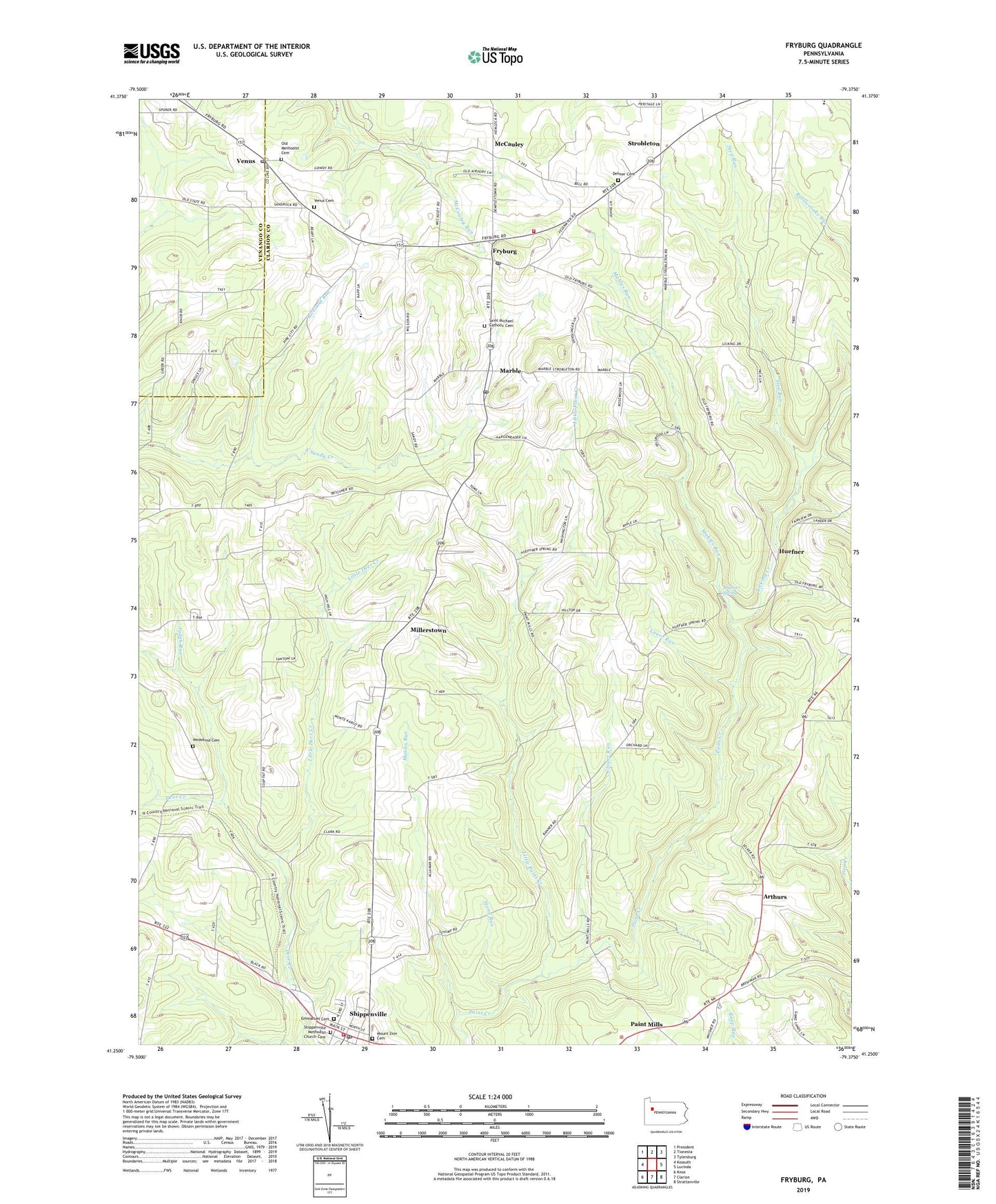
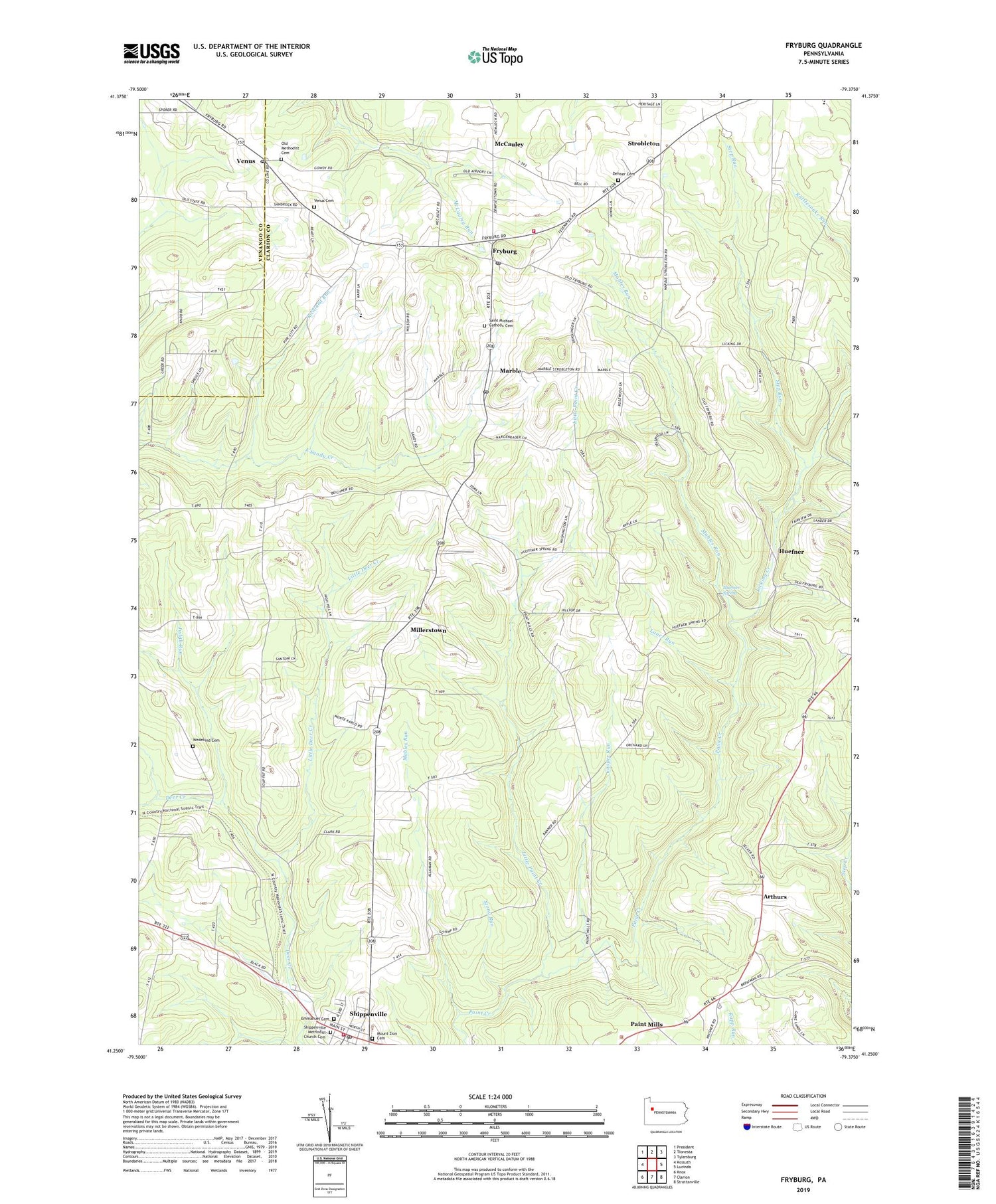
2019 topographic map quadrangle Fryburg in the state of Pennsylvania. Scale: 1:24000. Based on the newly updated USGS 7.5' US Topo map series, this map is in the following counties: Clarion, Venango. The map contains contour data, water features, and other items you are used to seeing on USGS maps, but also has updated roads and other features. This is the next generation of topographic maps. Printed on high-quality waterproof paper with UV fade-resistant inks.
Quads adjacent to this one:
West: Kossuth
Northwest: President
North: Tionesta
Northeast: Tylersburg
East: Lucinda
Southeast: Strattanville
South: Clarion
Southwest: Knox
Contains the following named places: Amsler School, Arthurs, Borough of Shippenville, Cohlhepp School, Cooper Run, Dehner Cemetery, Emmanuel Cemetery, Fryburg, Fryburg Post Office, Henlen School, Huefner, Huefner Spring, Iron City, Judith Run, Kahle School, Lauer Run, Laur School, Lewis School, Licking Creek, Little Deer Creek, Little Paint Creek, Mahles Run, Marble, Marble Post Office, McCauley, Millerstown, Mount Zion Cemetery, Old Methodist Cemetery, Paint Mills, Paint Mills School, Paint Mills Station, Rattlesnake School, Richland Run, Saint Michael Catholic Cemetery, Saint Michaels School, Shippenville, Shippenville - Elk Township Volunteer Fire Department Station 630, Shippenville Methodist Church Cemetery, Shippenville Post Office, Shippenville Station, Springer School, Step Run, Stony Run, Strobleton, Township of Elk, Township of Knox, Township of Washington, Venus, Venus Cemetery, Venus Post Office, Washington Township Volunteer Fire Department Station 670, Wedekind Cemetery, ZIP Codes: 16254, 16334