MyTopo
Knox Pennsylvania US Topo Map
Couldn't load pickup availability
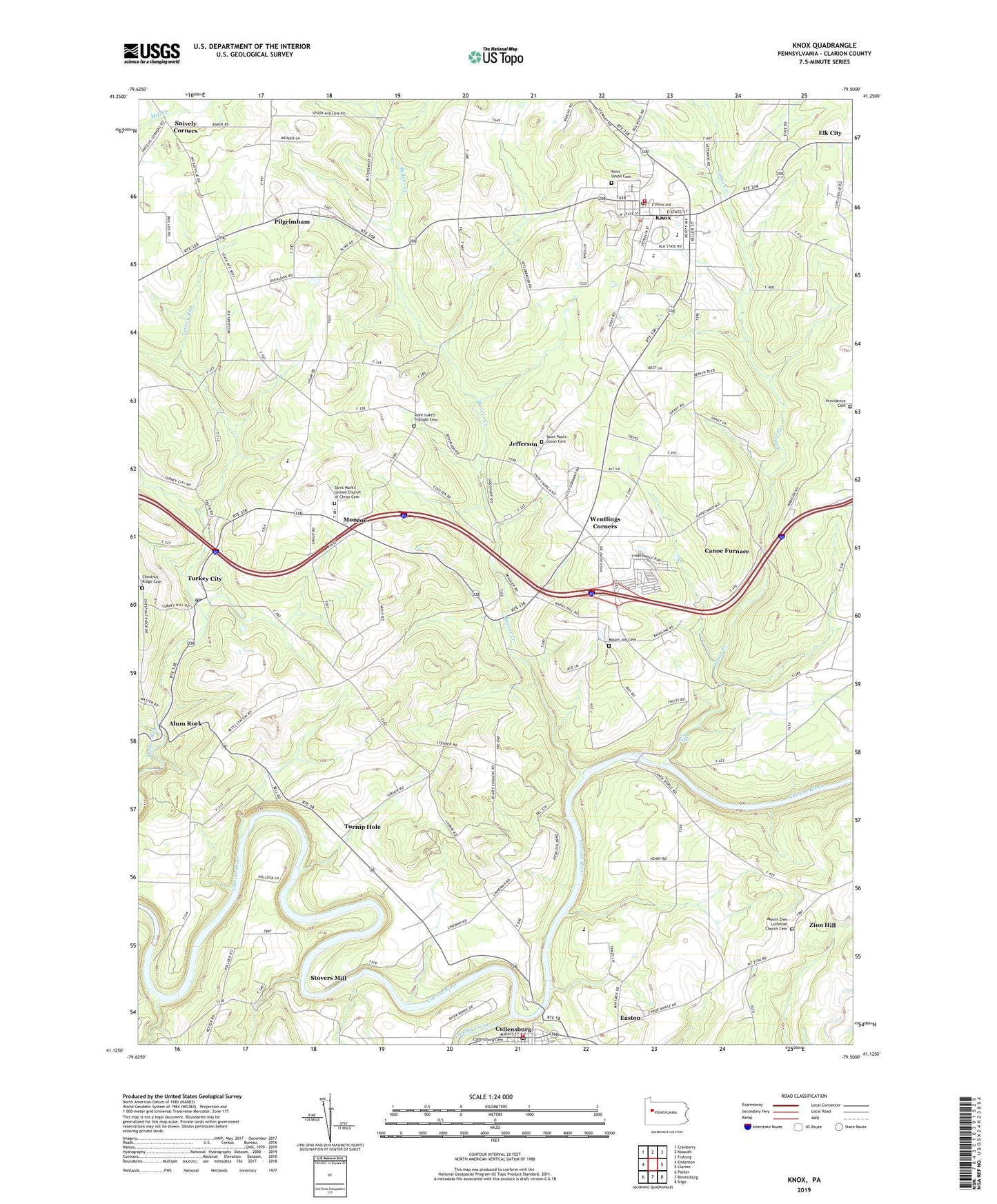
2023 topographic map quadrangle Knox in the state of Pennsylvania. Scale: 1:24000. Based on the newly updated USGS 7.5' US Topo map series, this map is in the following counties: Clarion. The map contains contour data, water features, and other items you are used to seeing on USGS maps, but also has updated roads and other features. This is the next generation of topographic maps. Printed on high-quality waterproof paper with UV fade-resistant inks.
Quads adjacent to this one:
West: Emlenton
Northwest: Cranberry
North: Kossuth
Northeast: Fryburg
East: Clarion
Southeast: Sligo
South: Rimersburg
Southwest: Parker
This map covers the same area as the classic USGS quad with code o41079b5.
Contains the following named places: Alum Rock, Alum Rock Post Office, Beaver City, Beaver Creek, Blairs Corners, Borough of Callensburg, Borough of Knox, Callensburg, Callensburg - Licking Township Volunteer Fire Department Station 510, Callensburg Post Office, Canoe Creek, Canoe Furnace, Canoe Ripple, Chestnut Ridge Cemetery, Easton, Elk City, Jefferson, Jefferson Station, Keystone Elementary School, Keystone Junior-Senior High School, Knox, Knox Area Volunteer Ambulance Company, Knox Borough Police Department, Knox Post Office, Knox Union Cemetery, Knox Volunteer Fire Company Station 570, Kropps Corners, Licking Creek, Martins Mill, Mongtown, Monroe, Mount Joy Cemetery, Mount Joy Church, Mount Zion Lutheran Church Cemetery, Pilgrimham, Providence Cemetery, Providence Church, Ritts, Saint Luke's Triangle Cemetery, Saint Marks Church, Saint Mark's United Church of Christ Cemetery, Saint Pauls Church, Saint Paul's Union Cemetery, Snively Corners, Stovers Mill, Township of Beaver, Township of Licking, Township of Salem, Triangle, Turkey City, Turkey City Post Office, Turnip Hole, Wentlings Corners, Zion Hill, ZIP Codes: 16213, 16232